Map detail of I-40 interstate highway California, Arizona, New Mexico, Texas, Oklahoma, Arkansas, Tennessee, North Carolina
Map interstate highway 40 route between cities Barstow, Flagstaff, Albuquerque, Amarillo, Oklahoma City, Little Rock, Memphis, Nashville, Greensboro, Raleigh, Wilmington
Interstate highway I-40 connects the cities of states: California, Arizona, New Mexico, Texas, Oklahoma, Arkansas, Tennessee, North Carolina. Detailed map of interstate route I40 with interchange and exit numbers.
Interstate 40 passes near several major cities: Barstow, Flagstaff, Albuquerque, Amarillo, Oklahoma City, Little Rock, Memphis, Nashville, Greensboro, Raleigh, Wilmington.
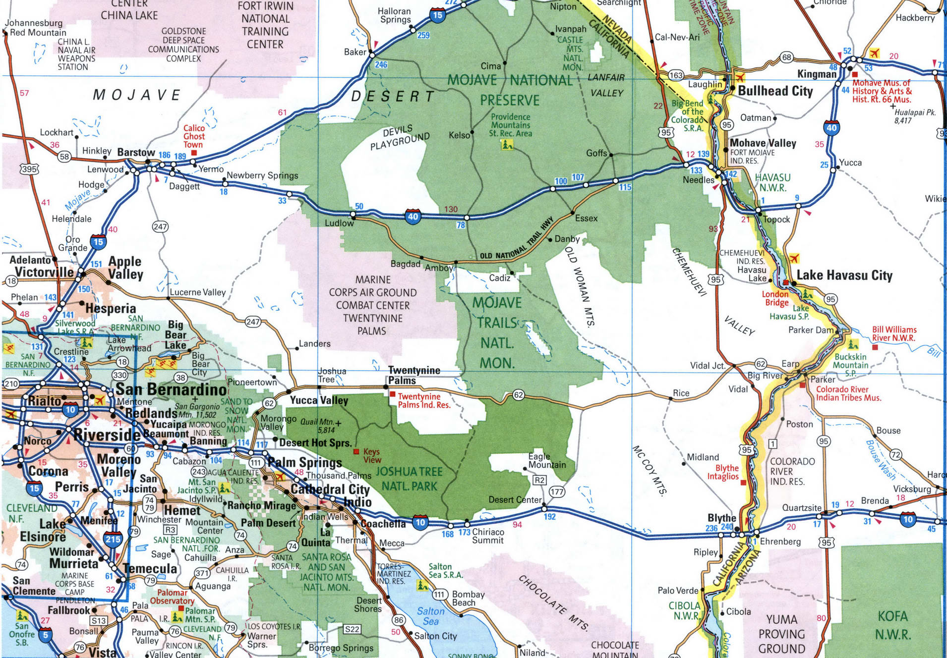
Map of inter-regional highway I-40 between Kingman, Flagstaff, Winslow.

Map of inter-regional highway I-40 between Sanders, Gallup, Albuquerque, Moriarty.

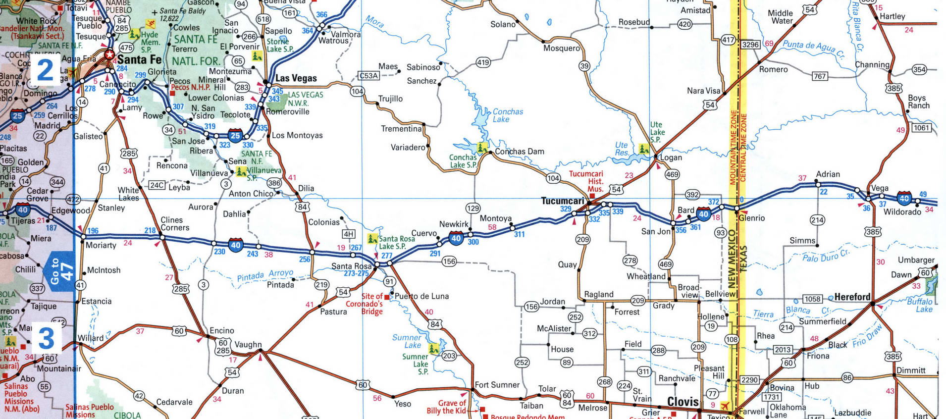
Map of inter-regional highway I-40 between Edgewood, Santa Rosa, Tucumcari, Bard, Vega.
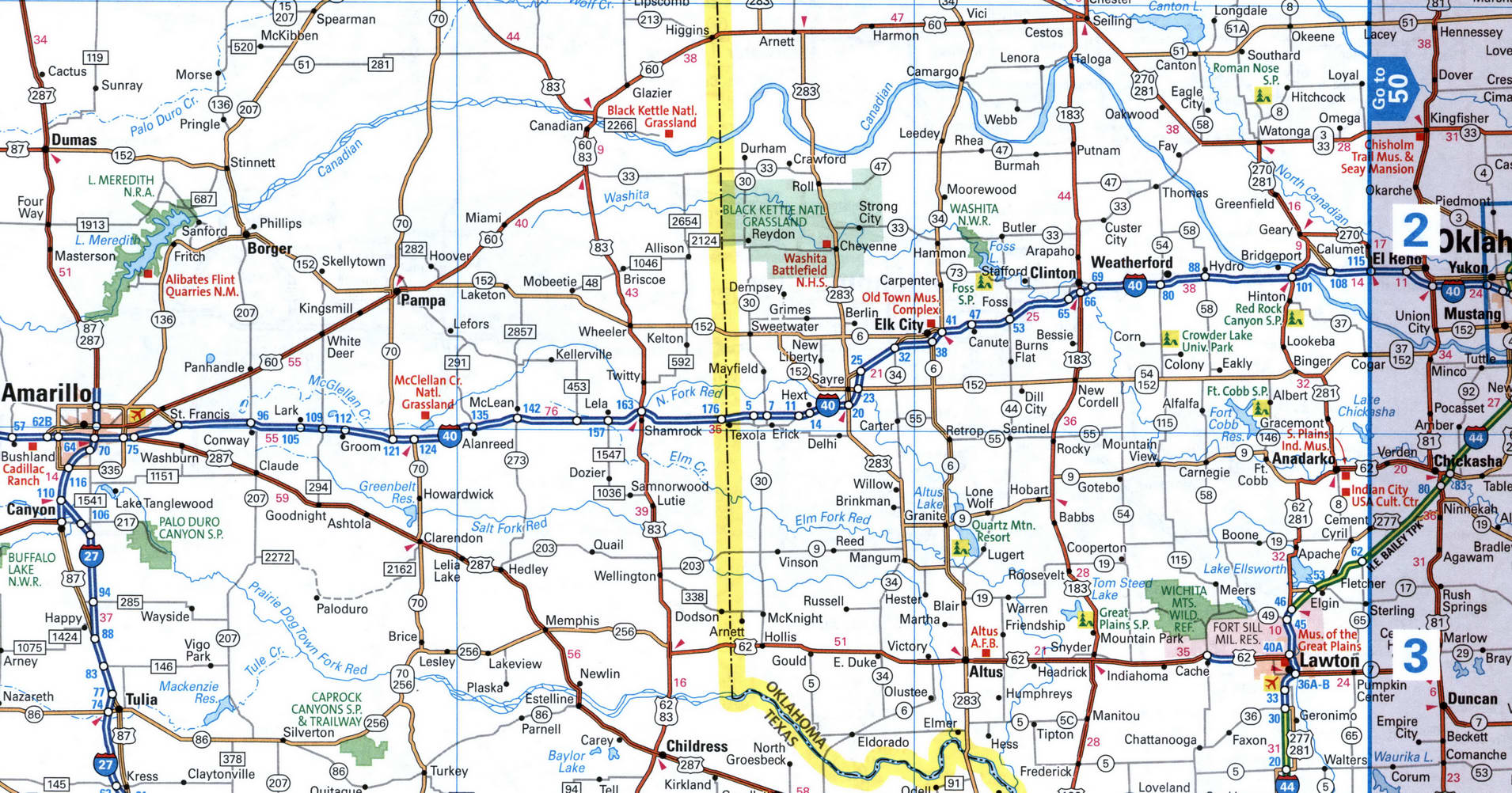
Map of inter-regional highway I-40 between Amarillo, Shamrock, Elk City, Clinton.
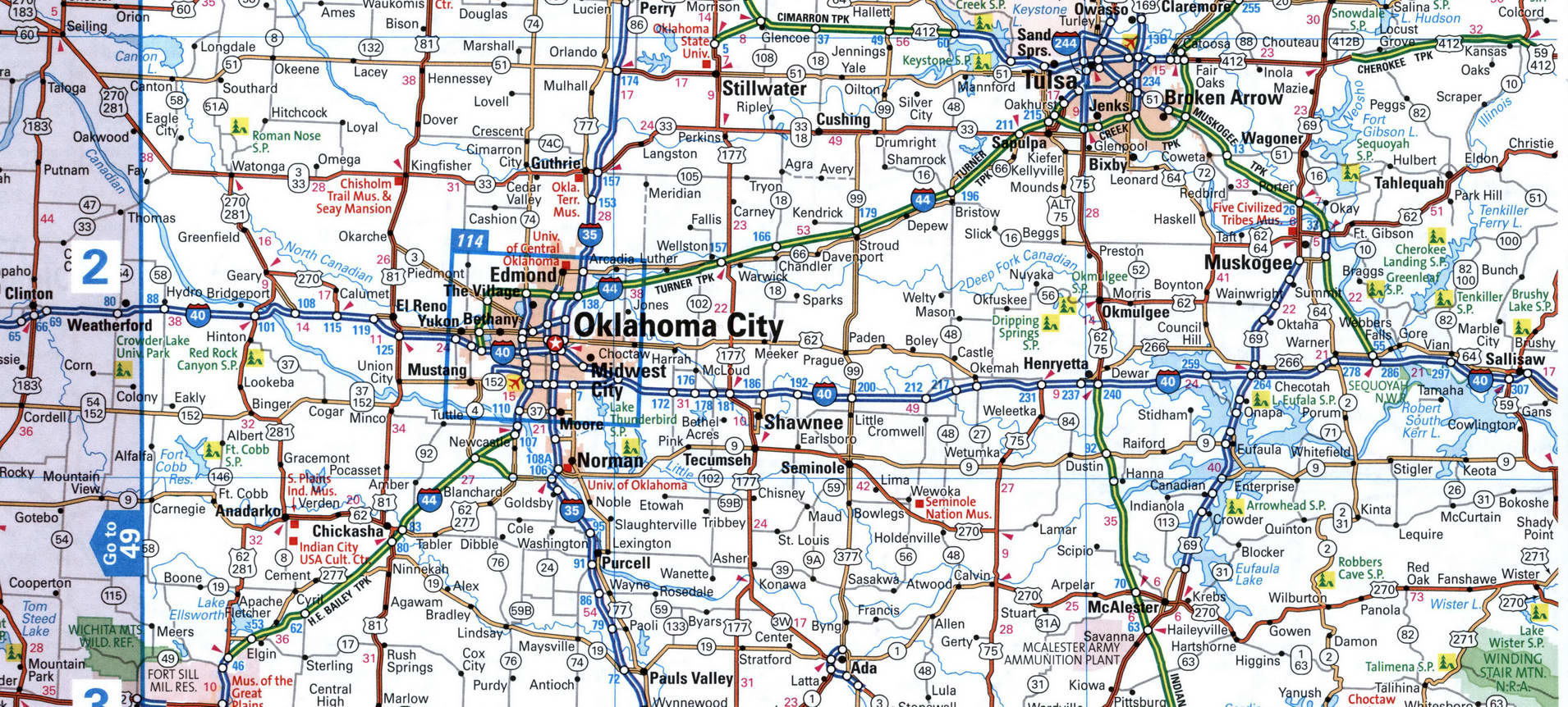
Map of inter-regional highway I-40 between Oklahoma City, Sallisaw
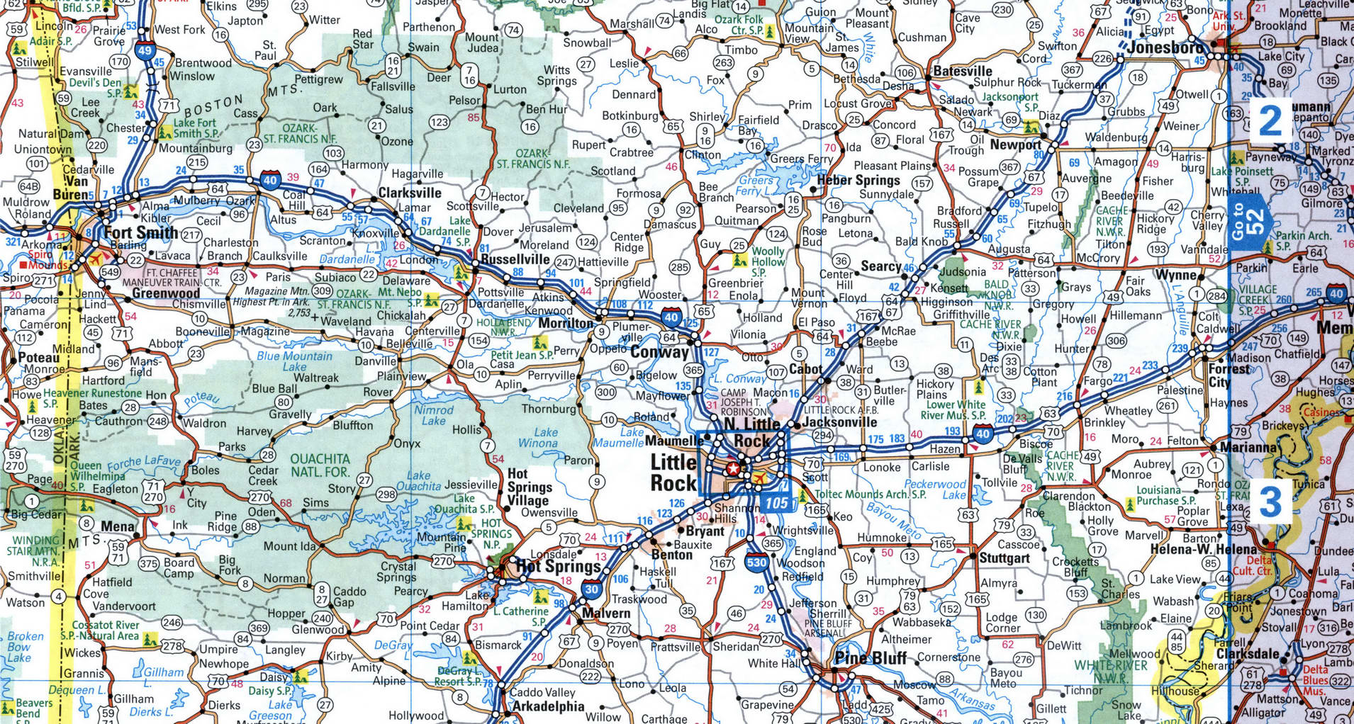
Map of inter-regional highway I-40 between Roland, Russellville, Conway, Little Rock, Forrest City
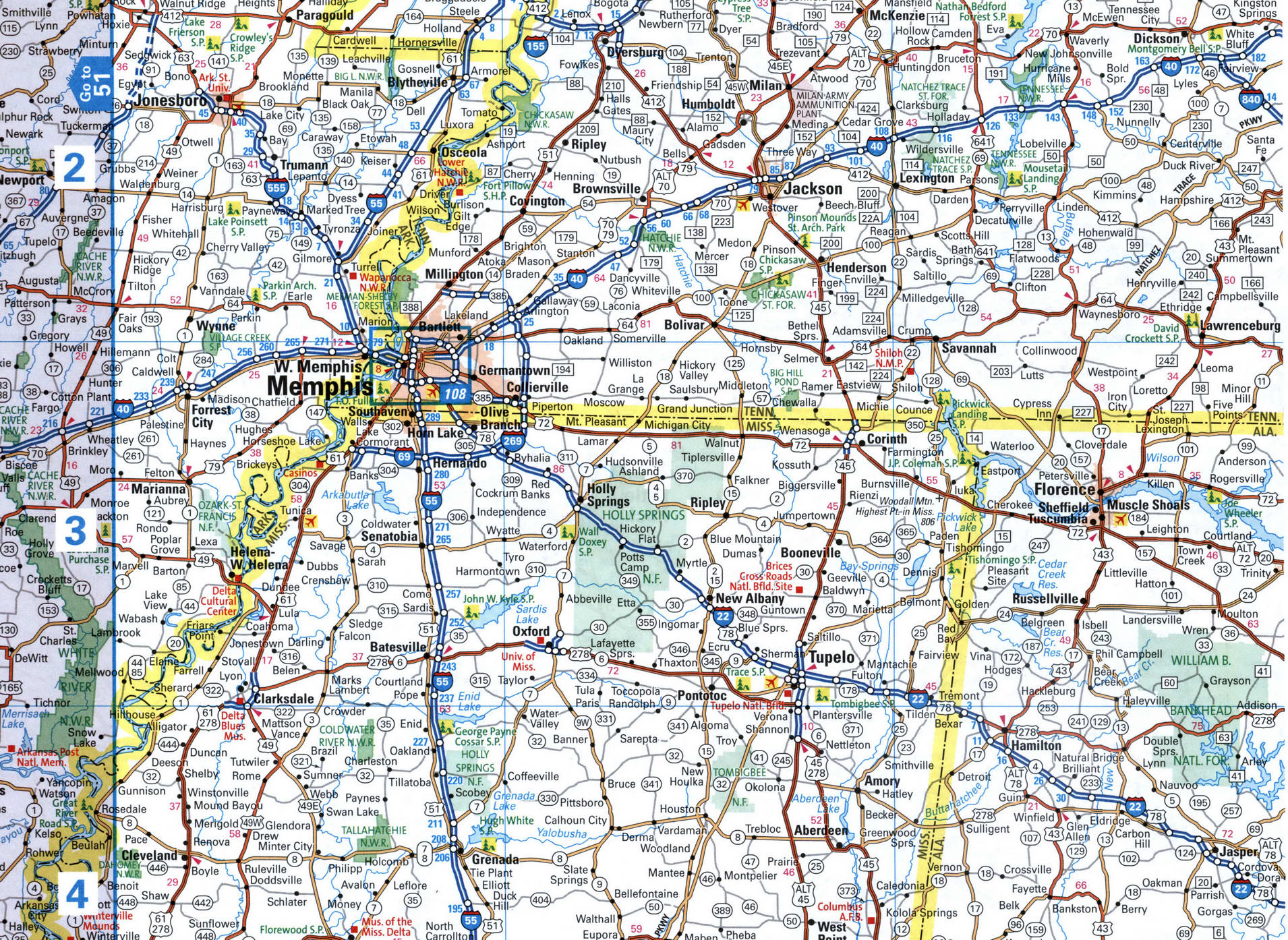
Map of inter-regional highway I-40 between Memphis, Jackson
Map of inter-regional highway I-40 between Nashville, Knoxville

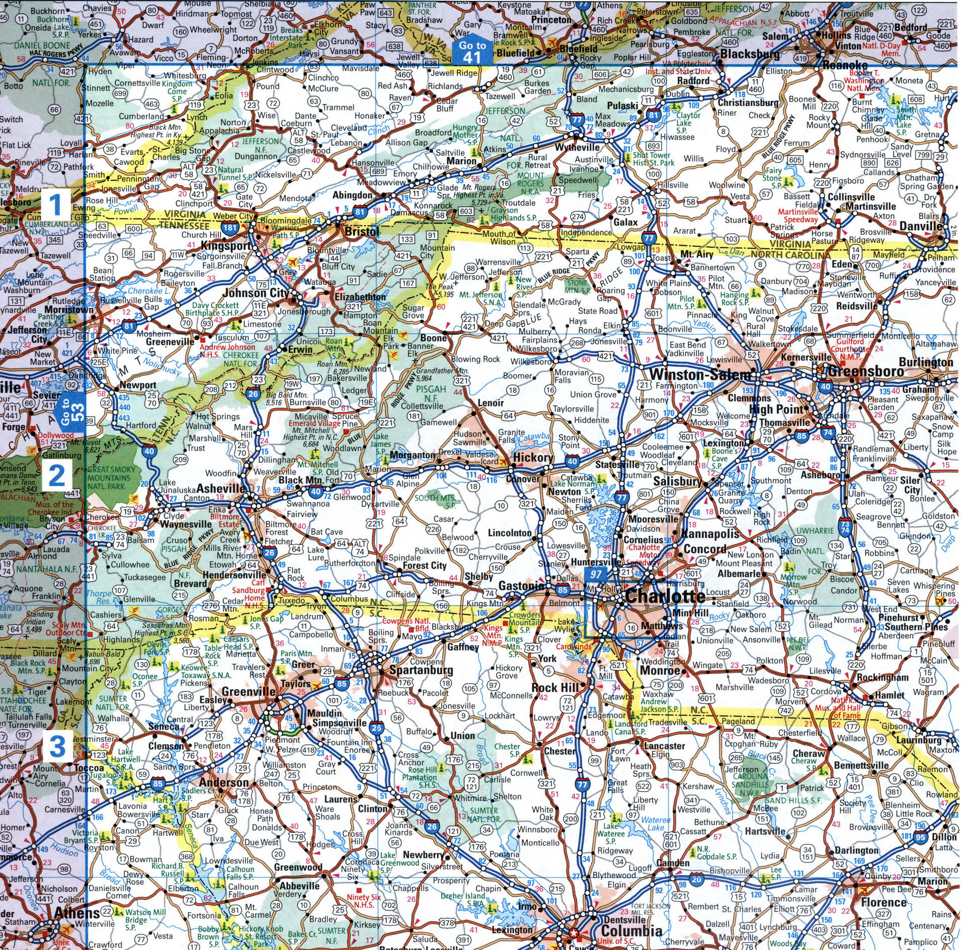
Map of inter-regional highway I-40 between Newport, Asheville, Hickory, Winston-Salem, Greensboro, Burlington
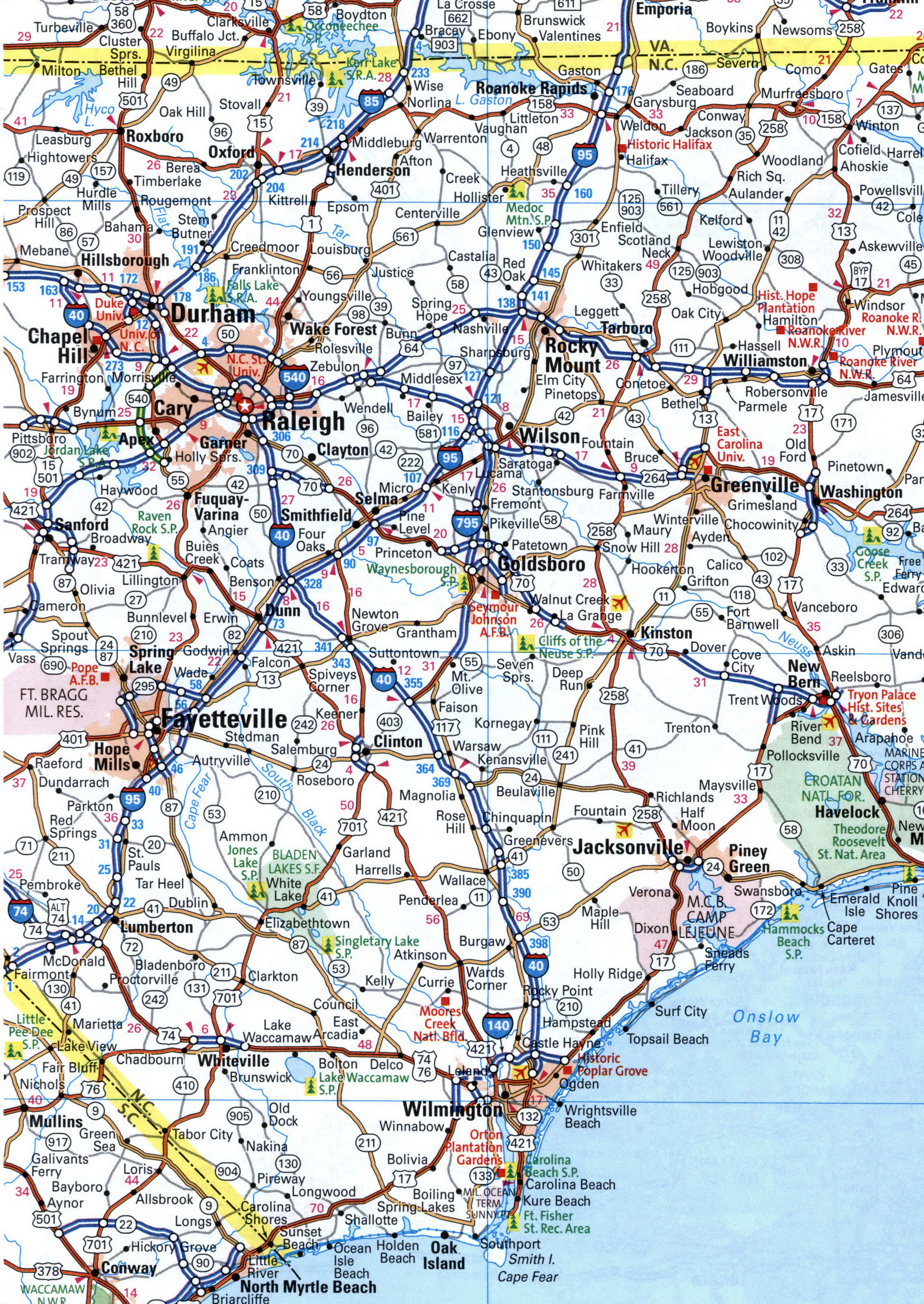
Map of inter-regional highway I-40 between Chapel Hill, Raleigh, Wilmington.
