Detailed map of the interstate highway I-20 Texas, Alabama, South Carolina - US

Go to content

Detailed map of the interstate highway I-20 Texas, Alabama, South Carolina

Map interstate 20 route between cities Midland, Abilene, Fort Forth, Dallas, Shreveport, Jackson, Tuscaloosa, Birmingham, Atlanta, Augusta, Columbia, Florence
Interstate highway I-20 connects the cities of Texas, Louisiana, Mississippi, Alabama, Georgia, South Carolina state. Detailed map of interstate route I-20 with interchange and exit numbers.
Interstate 20 passes near several major cities - Midland, Abilene, Fort Forth, Dallas, Shreveport, Jackson, Tuscaloosa, Birmingham, Atlanta, Augusta, Columbia, Florence.
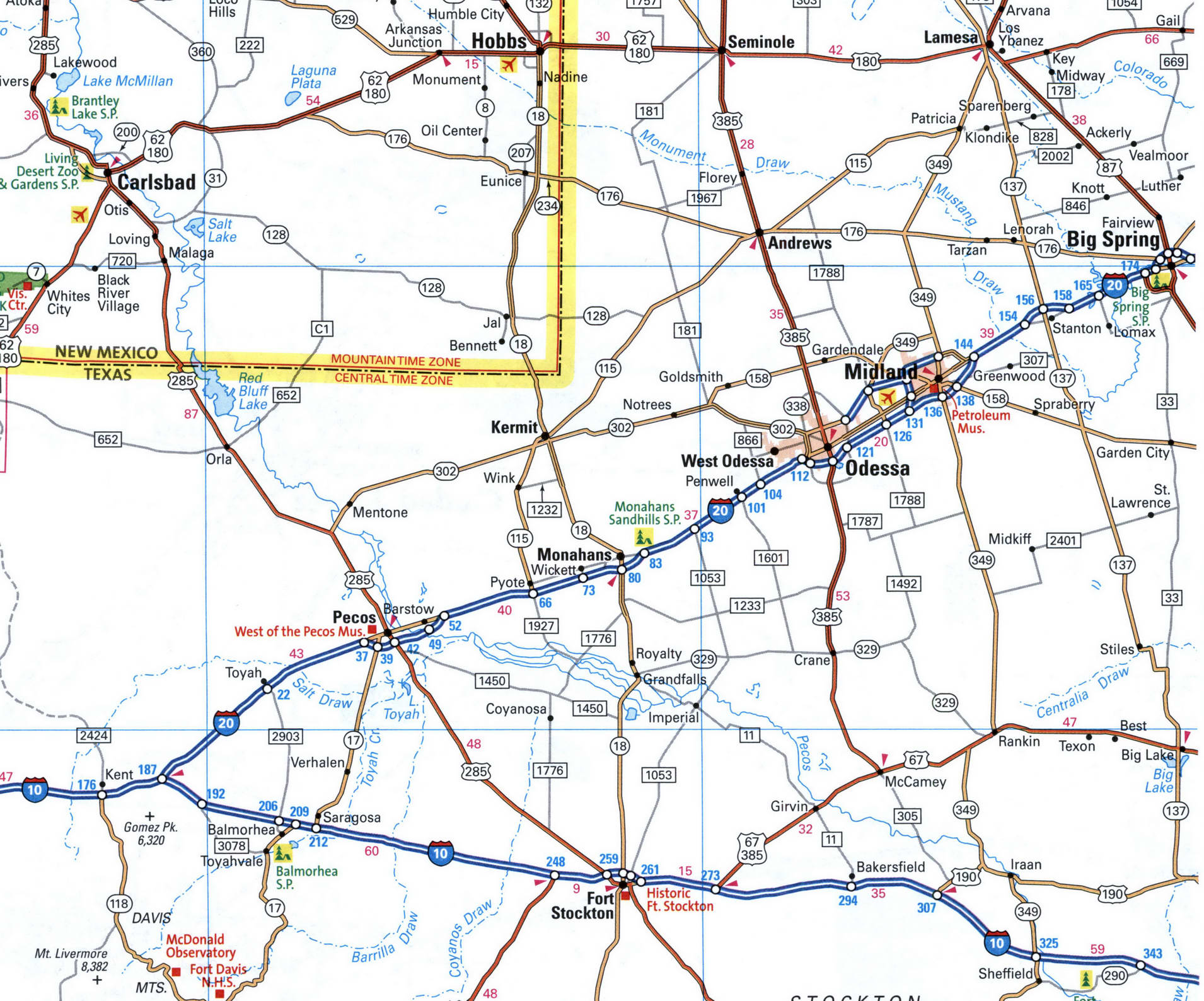
Map of I-20 in the Midland, Odessa area. Map of Interstate Highway 20. Detailed map of Interstate 20 with distances between exits and numbers of adjacent roads.
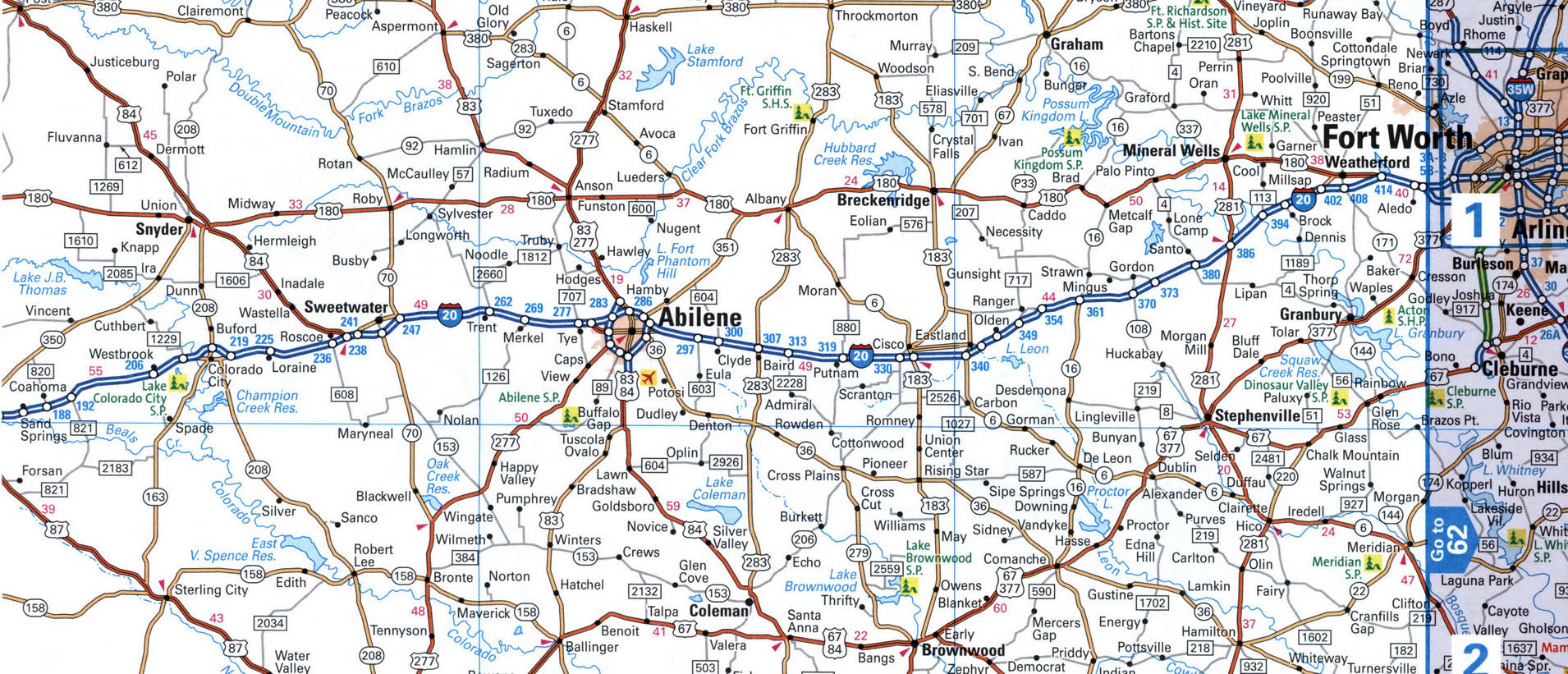
Abilene, Fort Worth
Map of I-20 in the Fort Worth area. Map of Interstate Highway 20. Detailed map of Interstate 20 with distances between exits and numbers of adjacent roads.
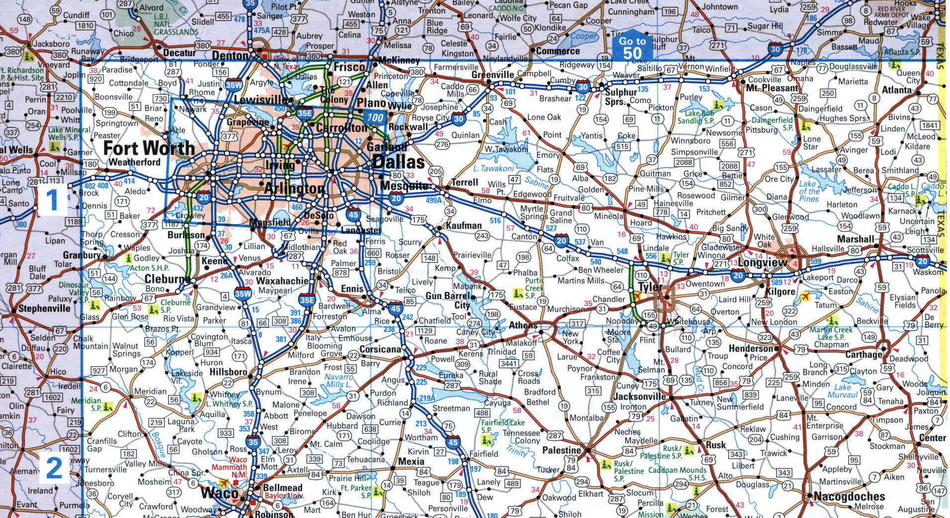
Fort Worth, Dallas, Longview
Map of I-20 in the Fort Worth area. Map of Interstate Highway 20. Detailed map of Interstate 20 with distances between exits and numbers of adjacent roads.
Shreveport, Monroe, Vicksburg, Jackson
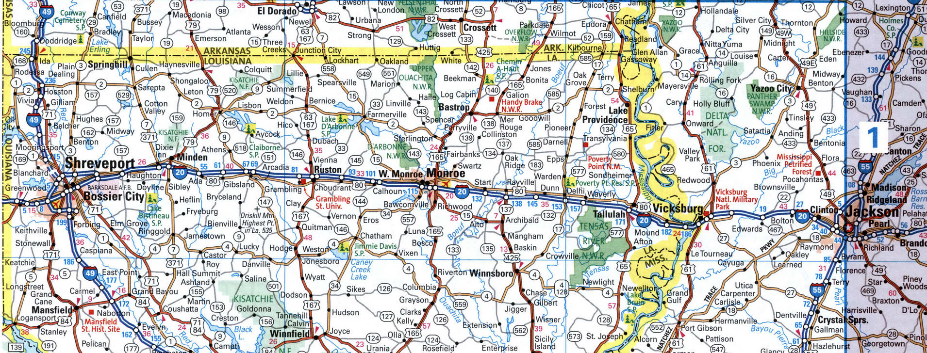
Map of I-20 in the Jackson area. Map of Interstate Highway 20. Detailed map of Interstate 20 with distances between exits and numbers of adjacent roads.
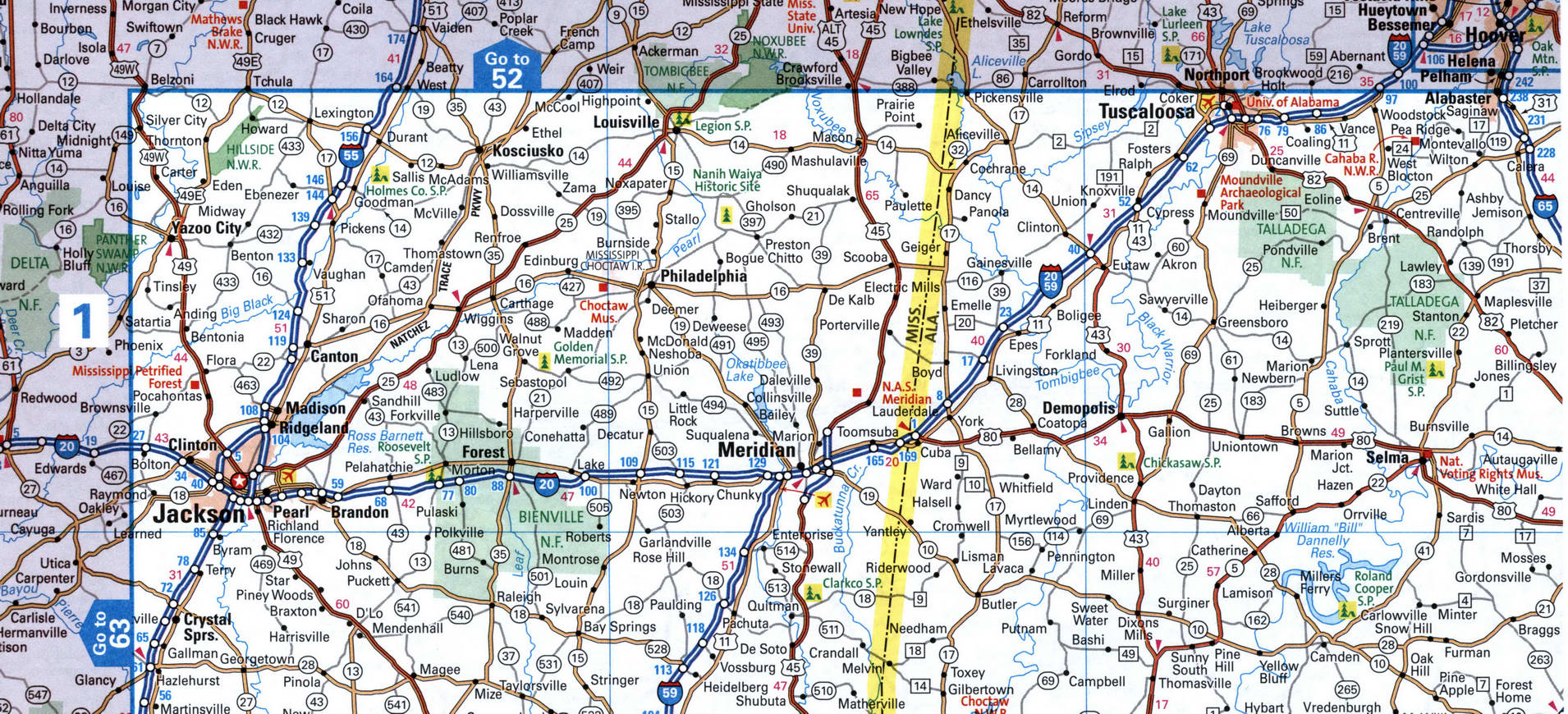
Jackson, Meridian, Tuscaloosa
Map of I-20 in the Jackson area. Map of Interstate Highway 20. Detailed map of Interstate 20 with distances between exits and numbers of adjacent roads.
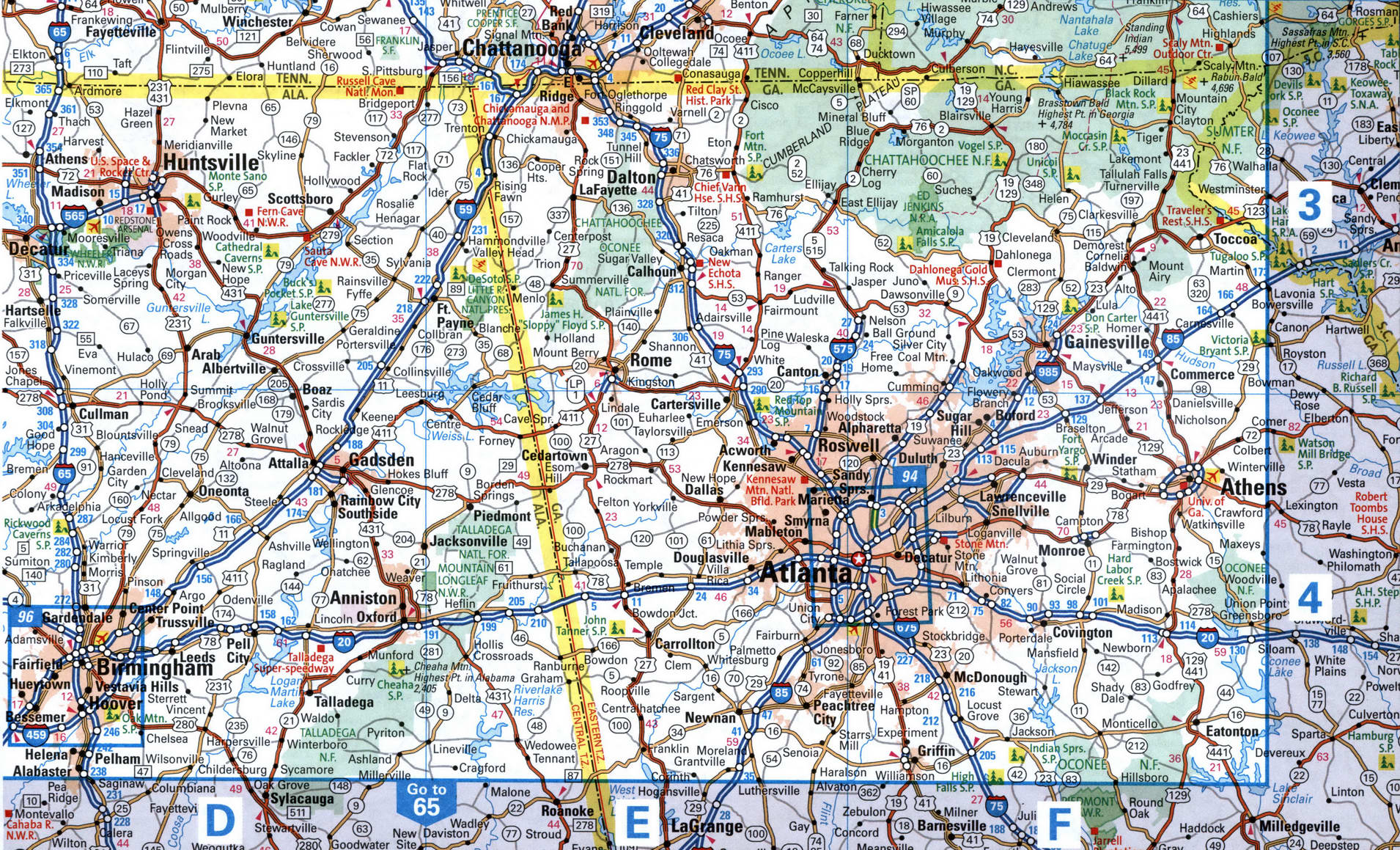
I-20 map Birmingham, Atlanta,
Map of I-20 in the Atlanta area. Map of Interstate Highway 20. Detailed map of Interstate 20 with distances between exits and numbers of adjacent roads.
I-20 route Augusta, Columbia, Florence
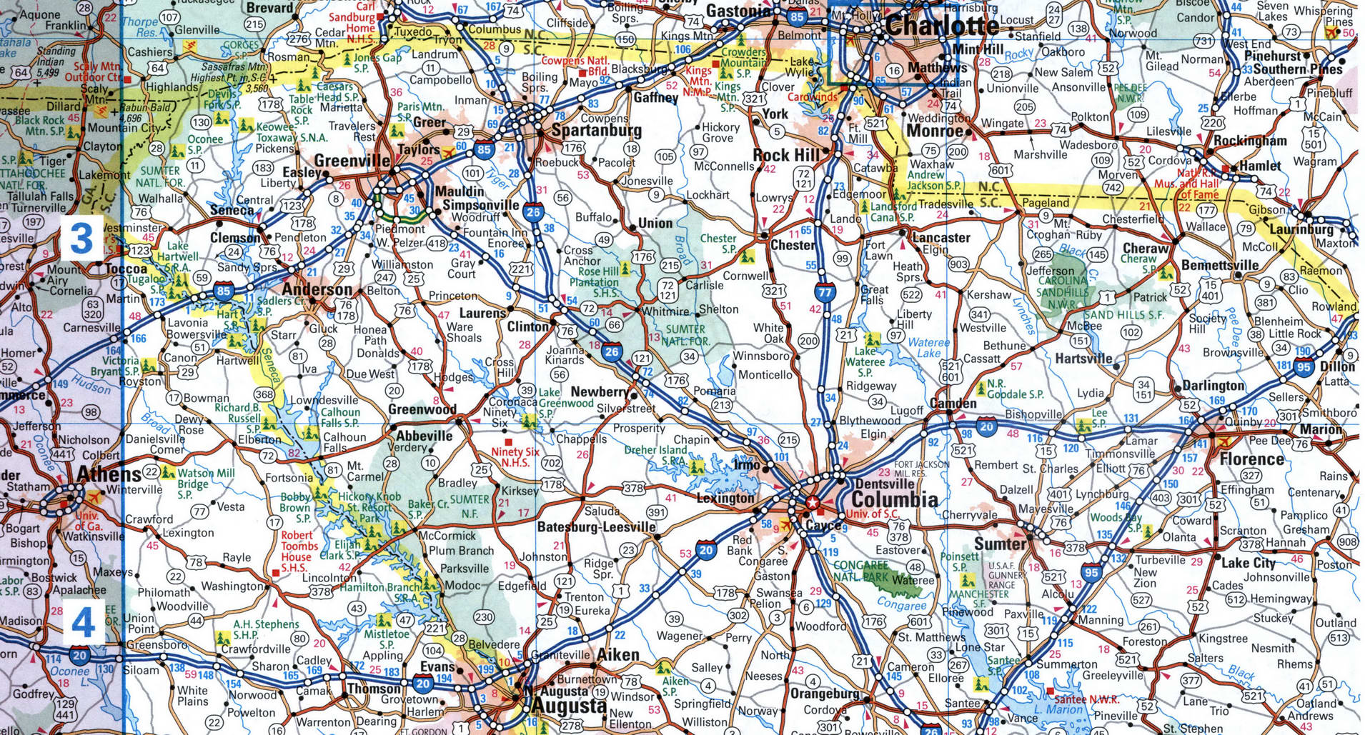
Map of I-20 in the Columbia area. Map of Interstate Highway 20. Detailed map of Interstate 20 with distances between exits and numbers of adjacent roads.
Back to content