Detailed map of the interstate highway I-25 New Mexico, Colorado, Wyoming - US

Go to content

Detailed map of the interstate highway I-25 New Mexico, Colorado, Wyoming

Map interstate 25 route between cities Casper, Douglas, Cheyenne, Fort Collins, Denver, Colorado Springs, Pueblo, Trinidad, Raton, Las Vegas, Santa Fe, Albuquerque, Las Cruces
Interstate highway I-25 connects the cities of states: New Mexico, Colorado, Wyoming. Detailed map of interstate route I25 with interchange and exit numbers.
Interstate 25 passes near several major cities: Casper, Douglas, Cheyenne, Fort Collins, Denver, Colorado Springs, Pueblo, Trinidad, Raton, Las Vegas, Santa Fe, Albuquerque, Las Cruces.
Map of I-25 in the Casper area. Map of Interstate Highway 25. Detailed map of Interstate 25 with distances between exits and numbers of adjacent roads.
I-25 route map Cheyenne, Denver, Colorado Springs,
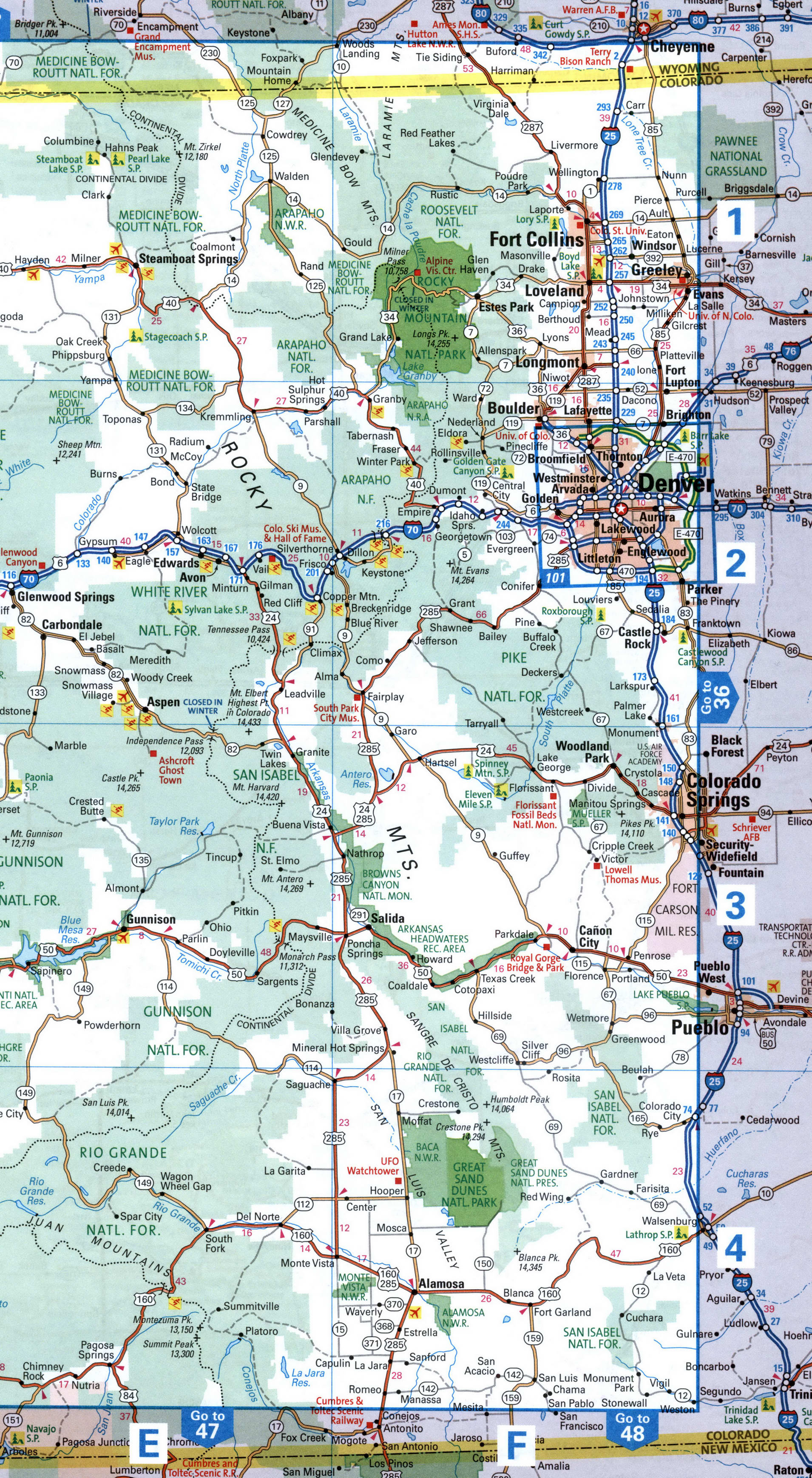
Map of I-25 in the Denver area. Map of Interstate Highway 25. Detailed map of Interstate 25 with distances between exits and numbers of adjacent roads.
Trinidad, Las Vegas, Santa Fe
Map of I-25 in the Santa Fe area. Map of Interstate Highway 25. Detailed map of Interstate 25 with distances between exits and numbers of adjacent roads.
Santa Fe, Albuquerque, Los Lunas, Socorro, Las Palomas
Map of I-25 in the Albuquerque area. Map of Interstate Highway 25. Detailed map of Interstate 25 with distances between exits and numbers of adjacent roads.
Caballo, Las Cruces, El Paso
Map of I-25 in the El Paso area. Map of Interstate Highway 25. Detailed map of Interstate 25 with distances between exits and numbers of adjacent roads.
Back to content