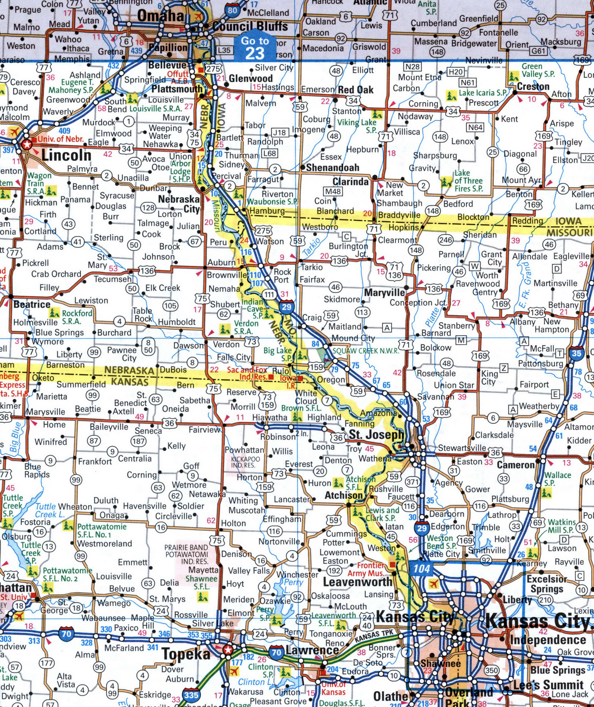
Detailed map of the interstate highway I-29 Missouri, Iowa, South Dakota, North Dakota - US

Go to content

Detailed map of the interstate highway I-29 Missouri, Iowa, South Dakota, North Dakota

Map interstate highway 29 route between cities Grand Forks, Fargo, Watertown, Sioux Falls, Sioux City, Omaha, Kansas City
Interstate highway I-29 connects the cities of states: Missouri, Iowa, South Dakota, North Dakota state. Detailed map of interstate route I29 with interchange and exit numbers.
Interstate 29 passes near several major cities: Grand Forks, Fargo, Watertown, Sioux Falls, Sioux City, Omaha, Kansas City.
Map of I-29 in the Fargo area. Map of Interstate Highway 29. Detailed map of Interstate 29 with distances between exits and numbers of adjacent roads.
Watertown, Sioux Falls, Sioux City, Omaha
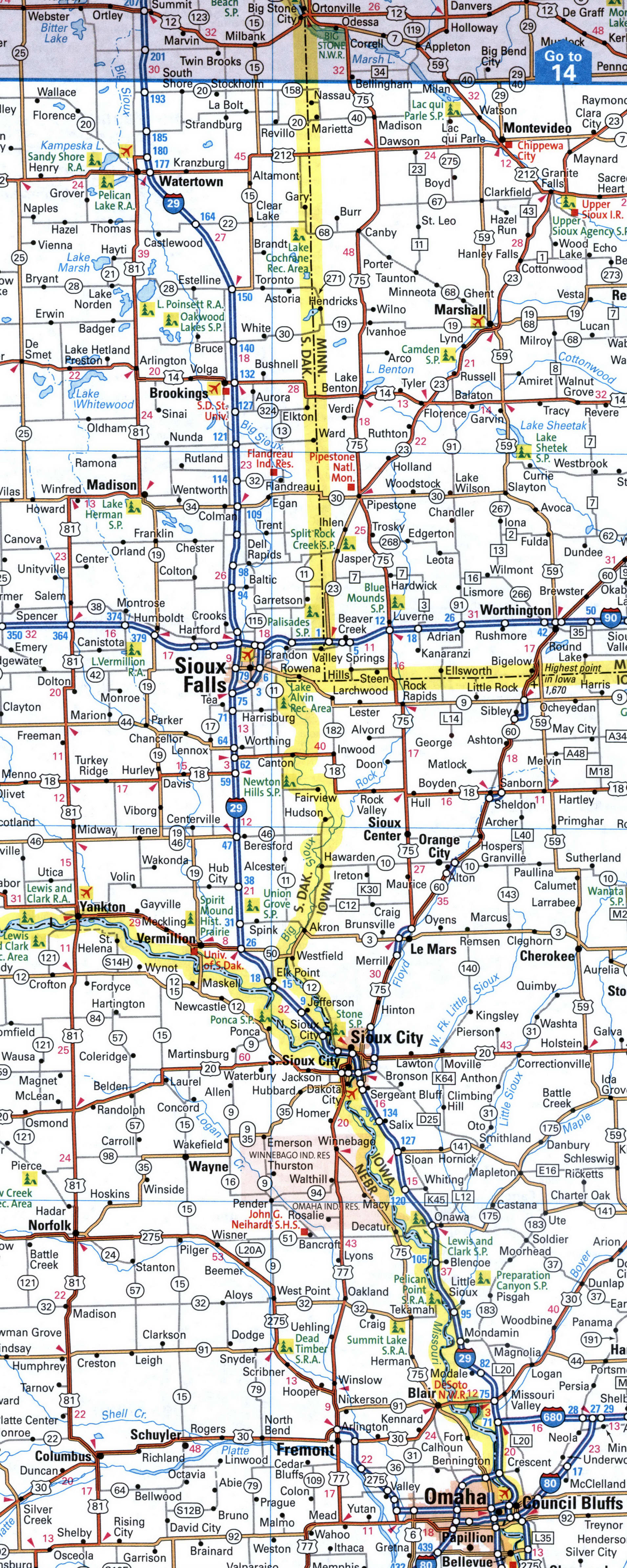
Map of I-29 in the Sioux Falls area. Map of Interstate Highway 29. Detailed map of Interstate 29 with distances between exits and numbers of adjacent roads.
Omaha, St Joseph, Kansas City
Map of I-29 in the Kansas City area. Map of Interstate Highway 29. Detailed map of Interstate 29 with distances between exits and numbers of adjacent roads.
Back to content