Detailed map of the interstate highway I-35 Texas, Oklahoma, Kansas, Missouri, Iowa, Minnesota - US

Go to content

Detailed map of the interstate highway I-35 Texas, Oklahoma, Kansas, Missouri, Iowa, Minnesota

Map interstate 35 route between cities Minneapolis, Mason City, Des Moines, Kansas City, Emporia, El Dorado, Wichita, Oklahoma City, Dallas, Waco, Austin, San Antonio, Laredo
Interstate highway I-35 connects the cities of states: Texas, Oklahoma, Kansas, Missouri, Iowa, Minnesota. Detailed map of interstate route I35 with interchange and exit numbers.
Interstate 35 passes near several major cities: Minneapolis, Mason City, Des Moines, Kansas City, Emporia, El Dorado, Wichita, Oklahoma City, Dallas, Waco, Austin, San Antonio, Laredo.
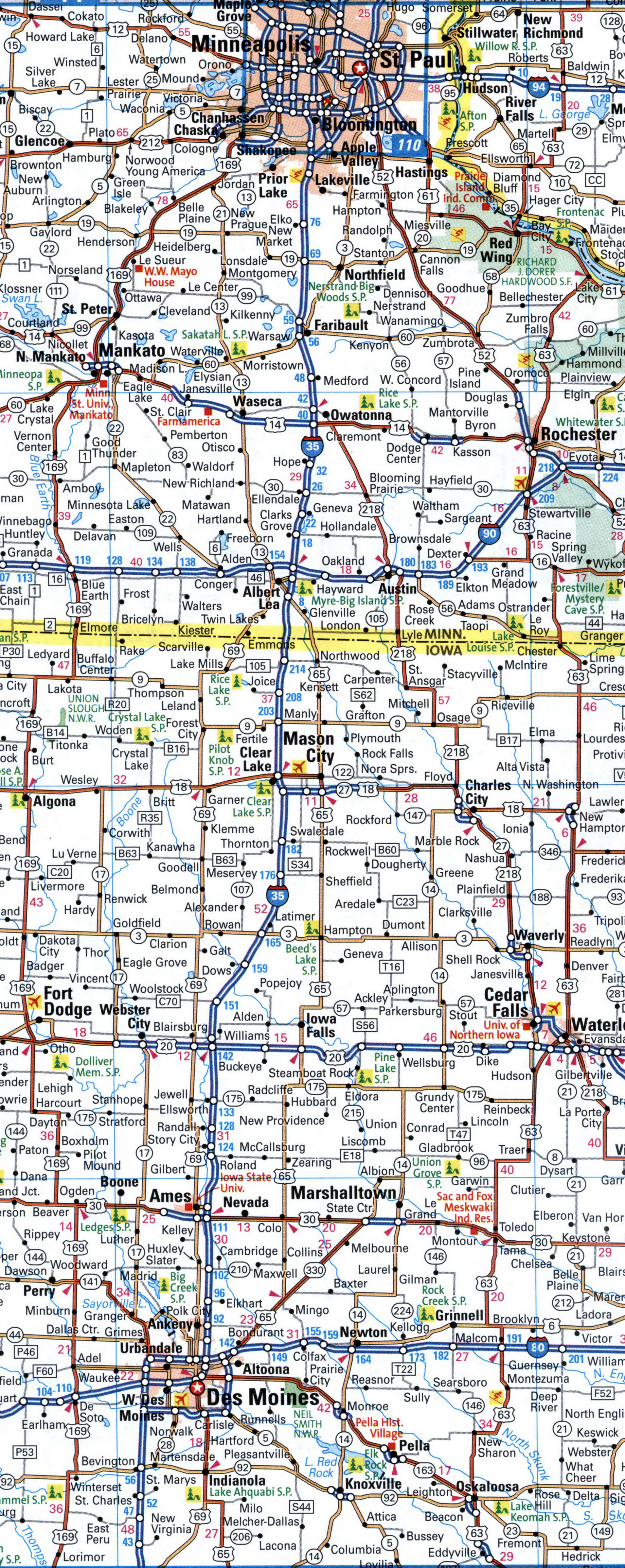
Map of I-35 in the Des Moines area. Map of Interstate Highway 35. Detailed map of Interstate 35 with distances between exits and numbers of adjacent roads.
Cameron, Kansas City, Emporia, El Dorado
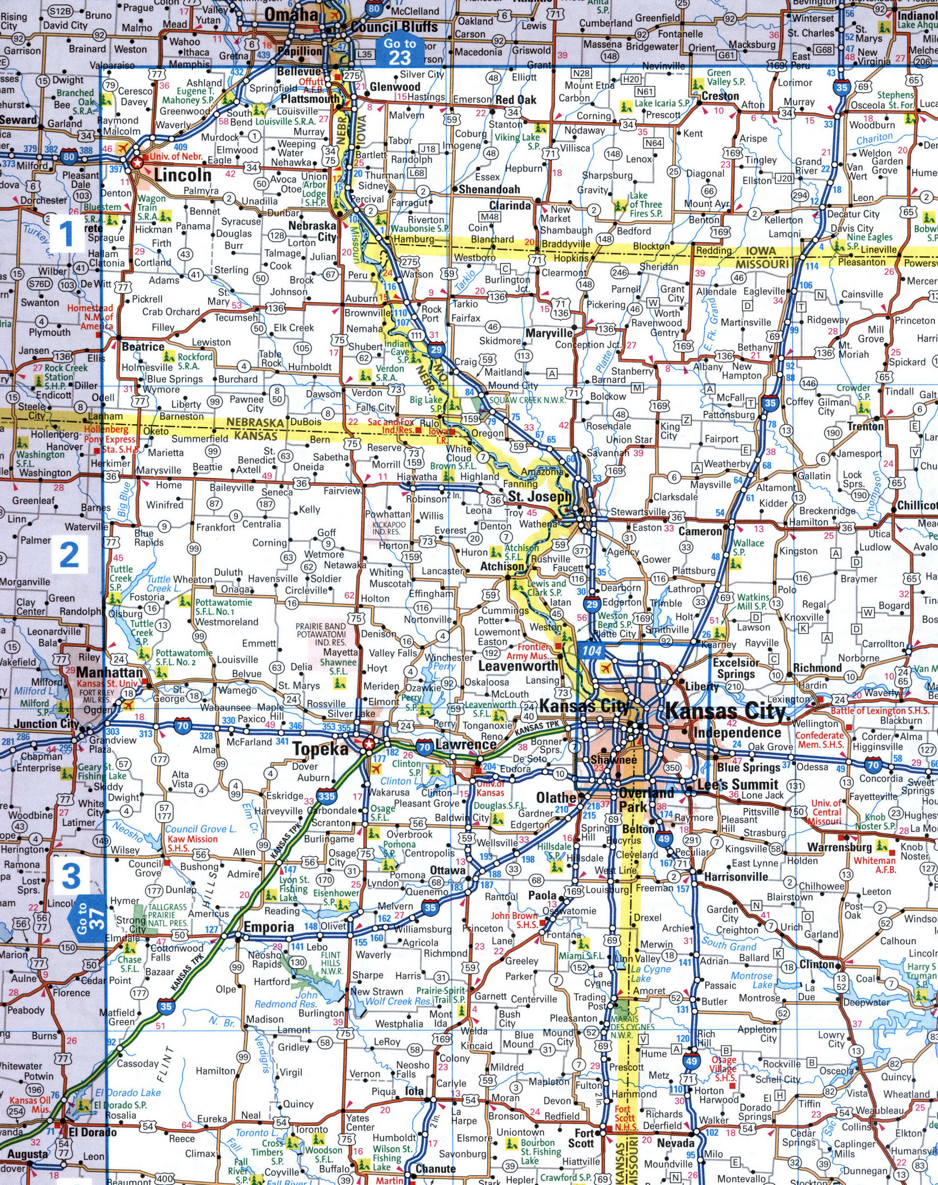
Map of I-35 in the Kansas City area. Map of Interstate Highway 35. Detailed map of Interstate 35 with distances between exits and numbers of adjacent roads.
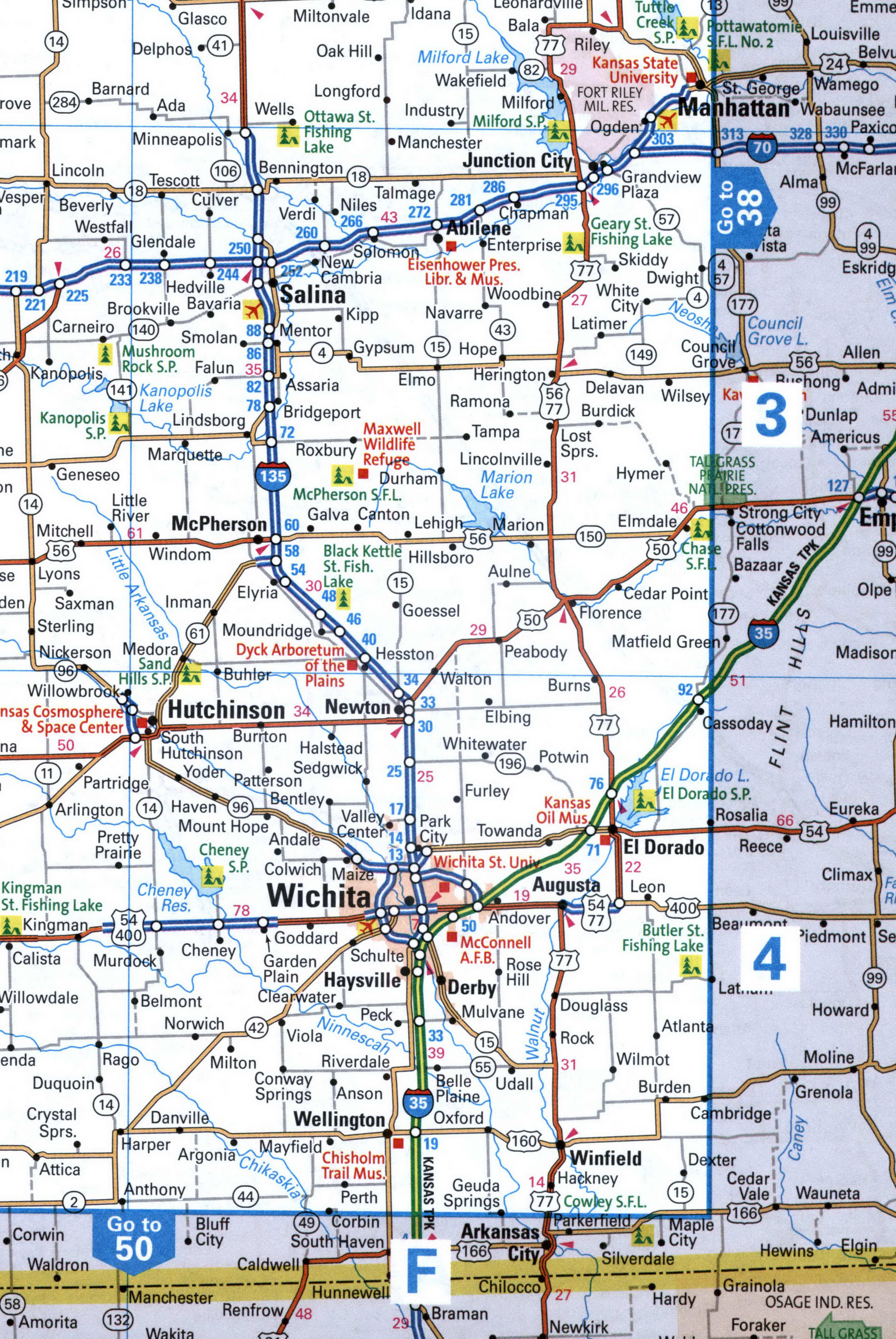
I-35 route El Dorado, Wichita,
Map of I-35 in the Wichita area. Map of Interstate Highway 35. Detailed map of Interstate 35 with distances between exits and numbers of adjacent roads.
I-35 route map Oklahoma City, Purcell, Ardmore, Denton.
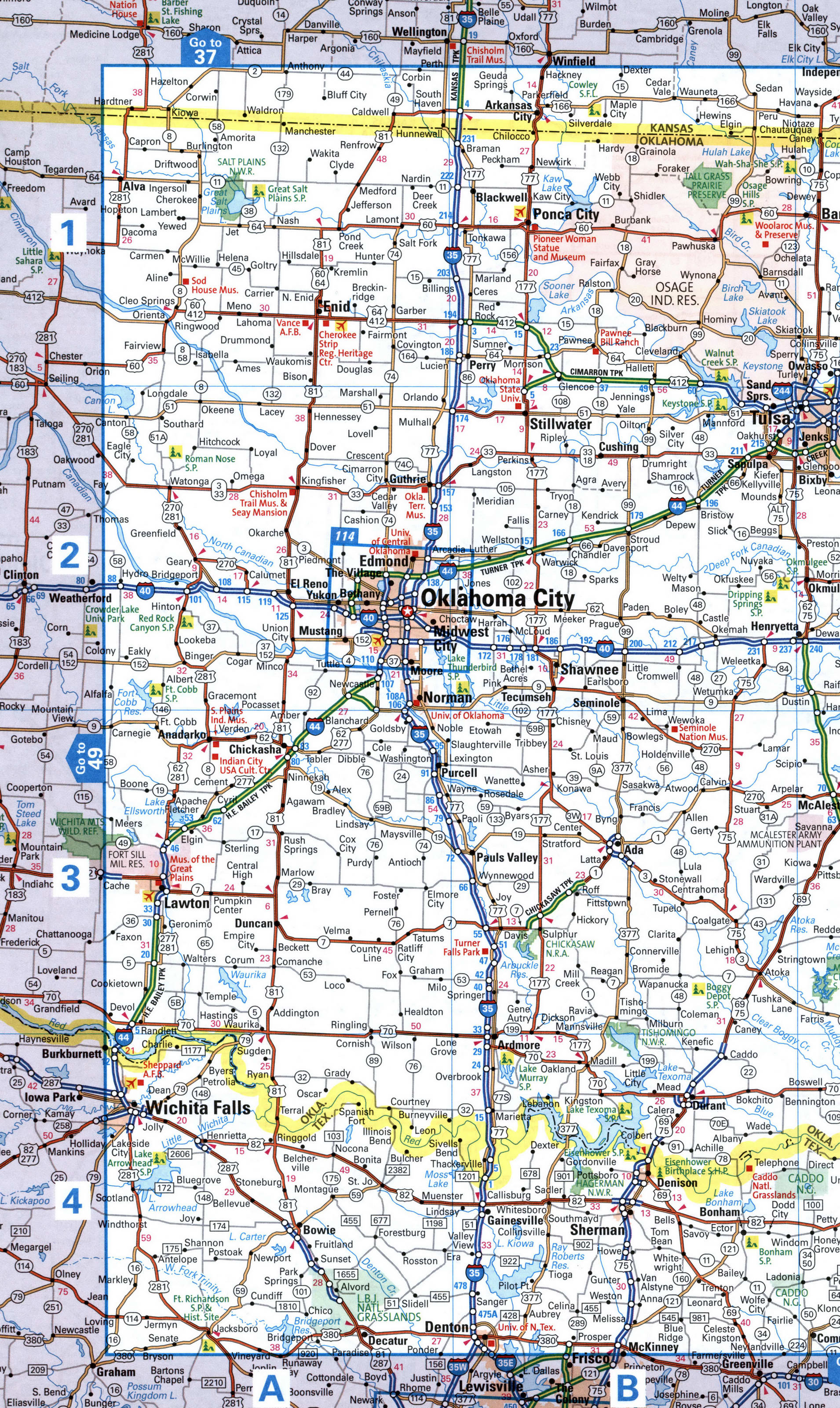
Map of I-35 in the Oklahoma City area. Map of Interstate Highway 35. Detailed map of Interstate 35 with distances between exits and numbers of adjacent roads.
Fort Worth, Waco, Temple, Austin, Marcos
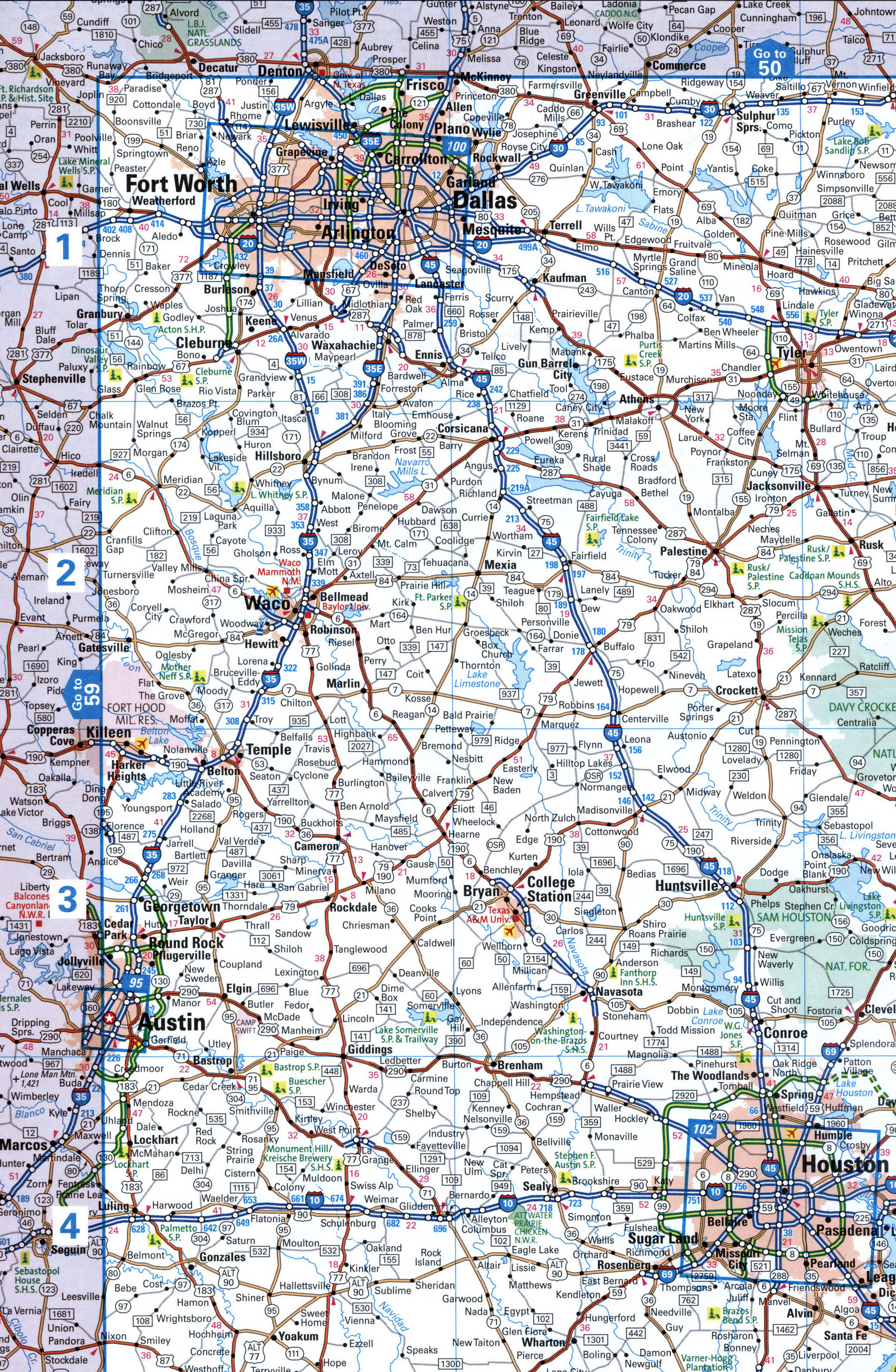
Map of I-35 in the Fort Worth area. Map of Interstate Highway 35. Detailed map of Interstate 35 with distances between exits and numbers of adjacent roads.
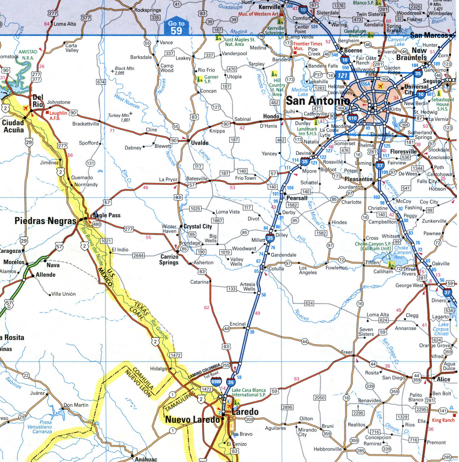
San Antonio, Laredo
Map of I-35 in the San Antonio area. Map of Interstate Highway 35. Detailed map of Interstate 35 with distances between exits and numbers of adjacent roads.
Back to content