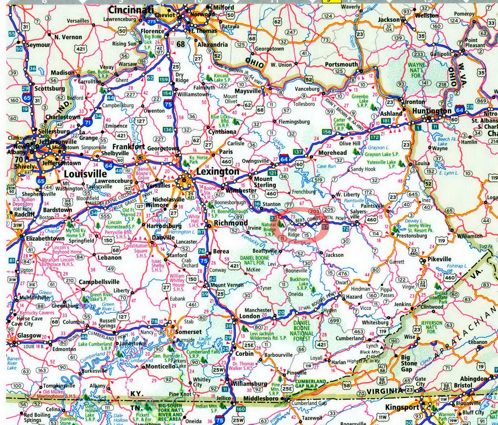
Koomer Ridge Campground in Kentucky on map

Koomer Ridge Campground
Koomer Ridge provides access to the Red River Gorge Geological Area.
Koomer Ridge Campground is perched on the edge of the Red River Gorge Geological Area. Among other things, this area has more natural arches within it than anywhere else in the East. The work of 70 million years of wind and water has resulted in more than 100 arches and countless rock formations of other kinds. Many of these arches can be accessed via 60 miles of foot trails or by short walks from scenic roads that penetrate the geological area. And to top it off, Koomer Ridge is an ideal tent campground.
But there is one little drawback— you can hear the autos driving the nearby Bert Combs Mountain Parkway from the campground. If you find this bothersome, read no further. I am no fan of car noise, but I found that the positives of Koomer Ridge easily overwhelm the one negative.
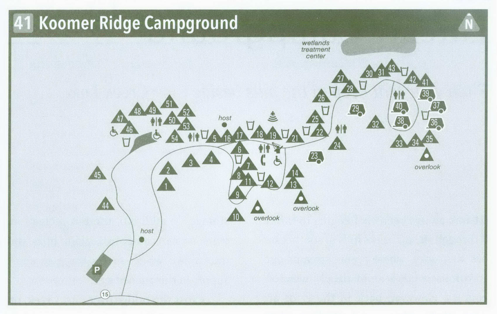
Now to the good parts. Pass the campground host, and veer right into this ridgetop camp. Pass shady, well-separated sites nestled off the road, and swing right on a small loop. The sites are on the inside of the loop, which often spells crummy camps, but not here at Koomer. The sites here are in good shape and offer more-than-adequate privacy and spaciousness. At the end of the loop is a fully equipped bathhouse that is in mint condition and kept that way by campground hosts. The main campground road continues along with widespread sites situated beneath pines, oaks, maples, and occasional hemlocks. Many of these are walk-in sites on the ridgeline, while others are classic pull-in sites. The road ends in a small loop with good sites spoking into the woods. I stayed at site 39.
Sites 44-54 are on their own. The first two lie along a separate road that leads to a parking area for walk-in tent campers. Three sites spurring off the Hidden Arch Trail are less shady than those on the main loop. The remaining six sites are connected to the parking area by gravel paths. Tent campers could proudly pitch their tents at any of these sites, which are served by a water spigot and vault toilet (the water is shut off during winter, however). Water spigots and newer-style vault toilets are spread throughout the rest of the campground. Koomer Ridge fills on most weekends, so, if you want to get a site during those times, try to make it here by noon on Friday. During the week, though, you will have no problems.
Hikers can explore the geological area directly from the campground. Start with the Cliff Trail, which offers views from rock bluffs. The Silvermine Arch Trail descends to a wide arch backed by a tall bluff. The Hidden Arch Trail swings around a bluffline to a smaller arch and then connects to the Koomer Ridge Trail, which is your ticket into the heart of the geological area. Longer loop possibilities can be experienced from Koomer Ridge Trail, which connects other trails.
If you don't want to walk a trail, take a scenic drive. On your way here, you passed the Tunnel Ridge Road, which leads through an old railroad tunnel. Beyond here are Star Gap Arch and other features like Double Arch, accessible by a short path. Chimney Top Rock Road leads to Chimney Top Rock and Princess Arch. It also overlooks the Red River, a National Wild and Scenic River that is a destination in its own right. KY 715 takes drivers to Skybridge, a huge arch with a far-reaching view of the Cliffy Wilderness, which lies east of the geological area and has many trails of its own. KY 715 continues along the Red River and passes Gladie Cabin, a log house from the 1800s. The visitors center here is open during the warm season. Other trails spur from these roads. Grab a map at the campground entrance and take off—just don't let a little auto noise bother you.
Key Information about Koomer Ridge Campground
ADDRESS: 705 West College Ave., Stanton, KY 40380
OPERATED BY: U.S. Forest Service
CONTACT: 606-663-2852, www . fs . usda . gov / dbnf
OPEN: Whole campground, mid-April-October; sites 44-54, year-round
SITES: 54
SITE AMENITIES: Picnic table, fire ring, lantern post, tent pad
ASSIGNMENT: First come, first served; no reservations
REGISTRATION: Self-registration on-site
FACILITIES: Hot showers, flush toilets, pay phone; vault toilets and no water during winter
PARKING: At campsites and walk-intent parking area
FEE: $18-$22 mid-April-October, $7 rest of year
ELEVATION: 1,240 feet
RESTRICTIONS in Koomer Ridge Campground
¦ Pets: On 6-foot leash only
¦ Fires: In fire rings only
¦ Alcohol: At campsites only
¦ Vehicles: No more than 2 per site
¦ Other: Bear-proof food storage regulations in effect
Getting to Koomer Ridge Campground
From Exit 33 on Bert Combs Mountain Parkway near Slade, take KY 15 South (it actually runs east) 5 miles to the campground, on your left.
GPS COORDINATES N37° 47.056' W83° 38.028'
