Littcarr Campground in Kentucky on map

Littcarr Campground
Pitch your tent deep in the hills beside Carr Creek Lake.
It has always been challenging to travel I through the mazelike hills of southeastern Kentucky, where scenic streams cut torturous courses amid deeply wooded country. However, back in the 1770s an intrepid hunter named William Carr made his way from Virginia into this beautiful yet forbidding country. His wanderings gave Carr Creek a name. And today, the Army Corp of Engineers has given us Carr Creek Lake, an alluring mountain-rimmed, linear impoundment with a practical side. See, mountain streams like Carr Creek are prone to flooding, but this tributary of the North Fork Kentucky River has been tamed, cutting down on flooding as well as providing water storage. In addition, there is recreation. Here, we can camp, fish, swim, hike, and even relax, which seems to be in short supply in this rushed age.
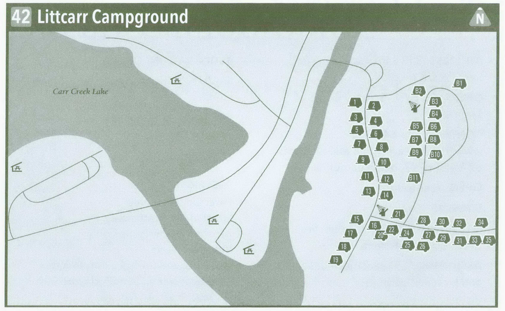
Cross the bridge over Carr Creek, on the upper end of the reservoir, and enter the campground. It is situated on a large, flat, and level area of a size rarely found in these wild Kentucky mountains. Sites 1-14 are situated along the main campground road. Odd-numbered sites face the water. Large, level parking and tent pads lie beneath a mix of sun and shade, with more sun than shade. Pass the bathhouse. Sites 15-19 are shaded and offer adequate solitude. Sites 20-24 would be good for those who like to be near the bathhouse and restroom. Sites 25-35 are situated up a deeply wooded hollow and provide even more solitude. These would be good for a hot day and are the preferred sites for solitude seekers such as myself. By the way, there are two picnic shelters across Carr Creek should you face a long rainy day. Playgrounds in that same area will serve camping children.
The B Loop was added years after the primary camping area. Like the main campground, B Loop offers high quality from stem to stern. B Loop is designed for bigger rigs, has its own shower house, and is well shaded. Its only drawback is being more distant from the water. Because Littcarr is well off the beaten path, campers usually stay for more than a day. And you should too. Reservations will give you peace of mind.
The main lake is beside and downstream of the campground, but a lesser dam is just above Littcarr. The campground is used primarily by anglers and families bent on getting away from it all.
Small by Army Corps of Engineers standards, Carr Creek Lake comes in at 710 acres. If you want to swim, I recommend heading to nearby Carr Creek State
Park and its beach. A drive through their campground will confirm you made a better choice at Littcarr. Anglers can be found plying the slender shoreline of Carr Creek Lake. Smallmouth and largemouth bass, crappie, catfish, and sunfish are the most sought-after species. A boat ramp is just south of Littcarr Campground. Hikers can tackle a pair of short nature trails, one of which starts at the nearby White Pine Shelter. The other nature trail begins at the Carr Creek Lake Dam tailwater area. Sugar Branch Trail wanders the wild north side of the impoundment, making a 6-mile one-way trek. The best access for Sugar Branch Trail is also at the tailwater area below the dam. Whether you hike or just relax, take time to visit this snakelike lake deep in the hollows and hills of Kentucky's far east.
Key Information about Littcarr Campground
ADDRESS: 843 Sassafras Creek Rd., Sassafras, KY 41759
OPERATED BY: U.S. Army Corps of Engineers
CONTACT: 606-642-3052, www . lrl . usace . army . mil ; reservations: 877-444-6777, reserveamerica . com
OPEN: Year-round
SITES: 45
SITE AMENITIES: Picnic table, fire grate, water, electricity
ASSIGNMENT: First come, first served and by reservation
REGISTRATION: On-site
FACILITIES: Hot showers, flush toilets, laundry
PARKING: At campsites FEE: $22-$28 ELEVATION: 1,275 feet
RESTRICTIONS in Littcarr Campground
Pets: On leash only Fires: In fire grates only Alcohol: At campsites only Vehicles: None
Other: Quiet hours 10 p.m.-6 a.m.; 14-day stay limit in a 30-day period
Getting to Littcarr Campground
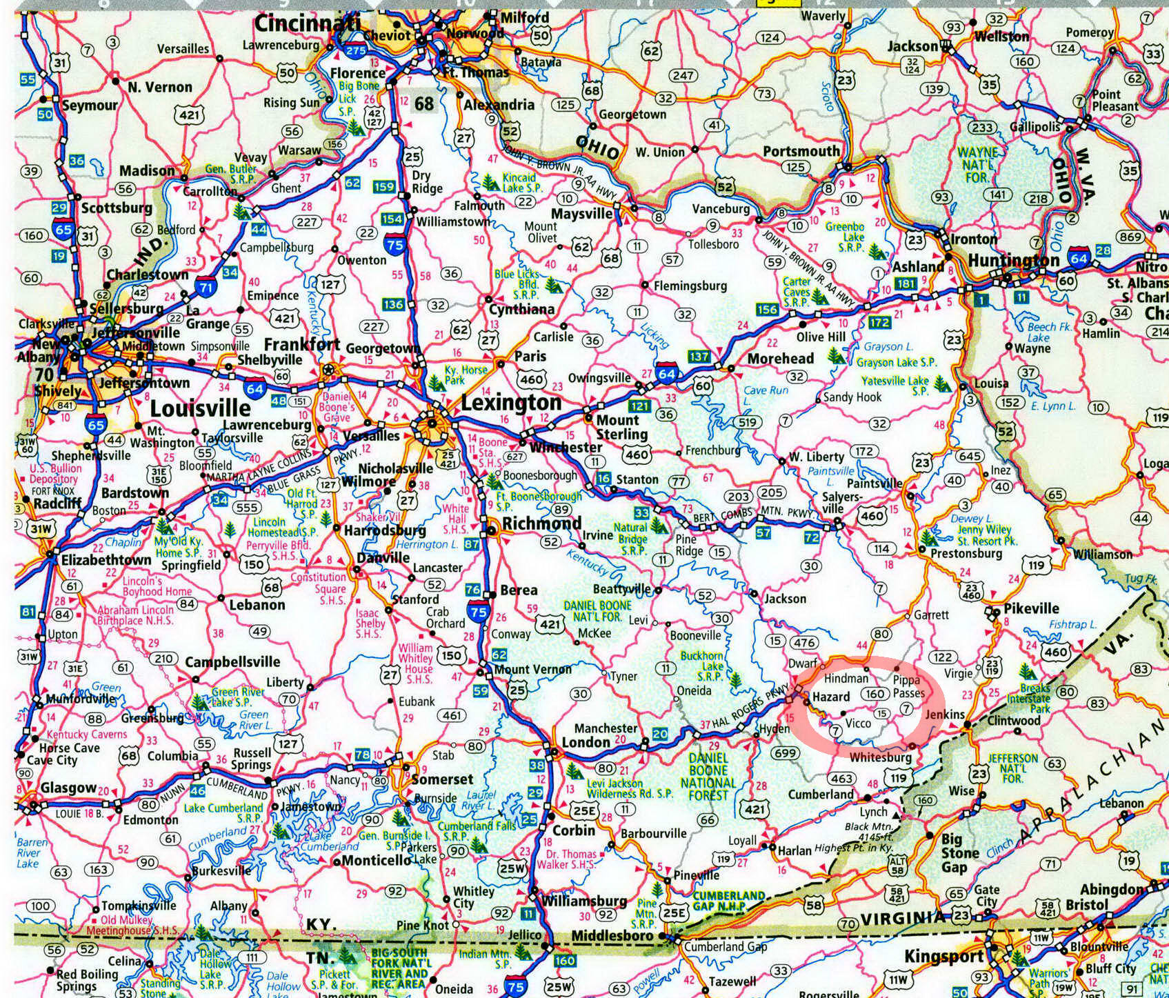
From Hazard, take KY 15 east 16.6 miles to KY 160. Turn left on KY 160 and follow it 2 miles to reach the right turn into Littcarr Campground.
GPS COORDINATES N37° 14.207' W82° 56.965
