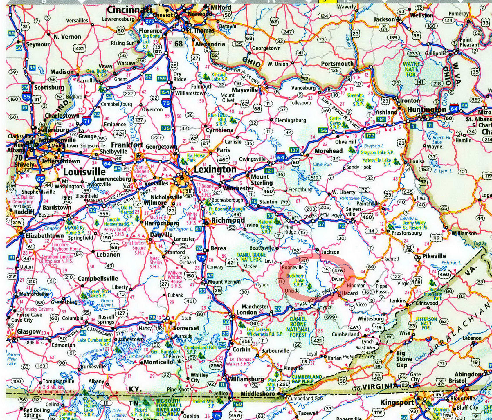
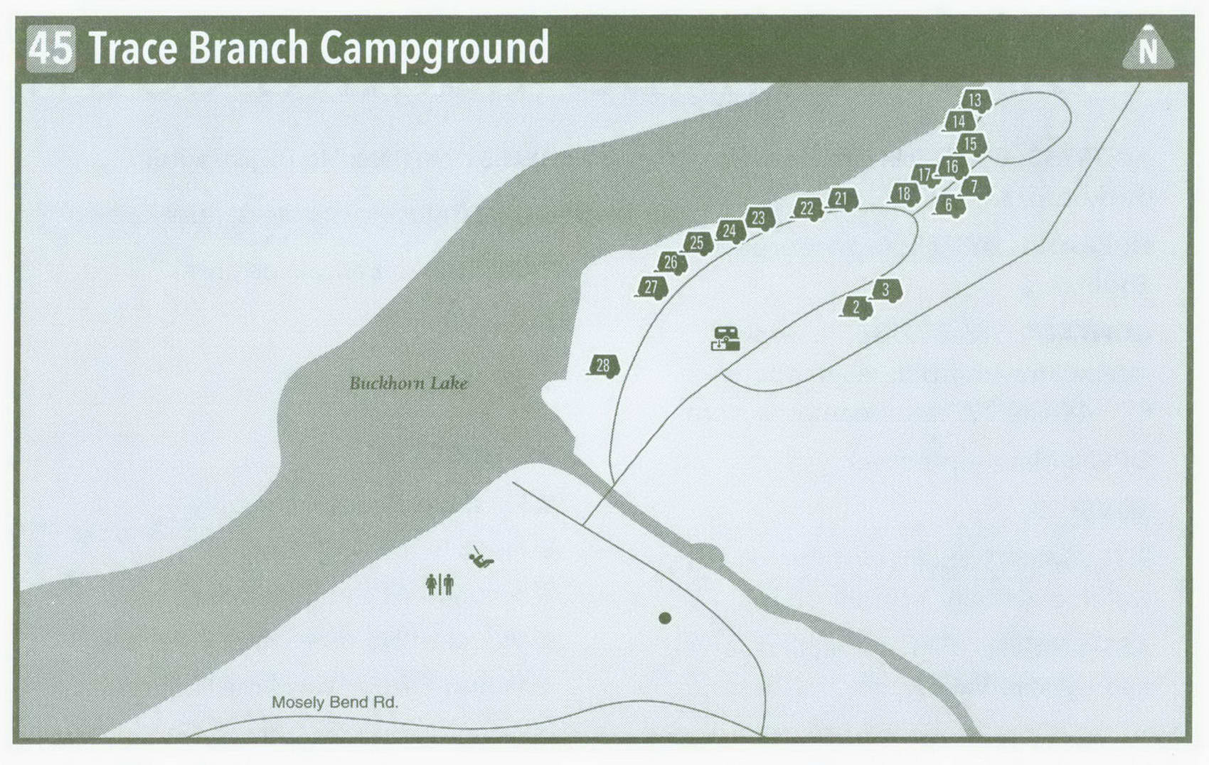
Trace Branch Campground in Kentucky on map

Tracp Branch Campground
Come here if you want to do nothing but relax.
Trace Branch Recreation Area is in the back of beyond—neither on the way to anywhere nor easy to reach. Tortuous roads try to find a way through Perry and Leslie Counties toward Buck-horn Lake, which is an impoundment of the Middle Fork Kentucky River. And after you begin to think Trace Branch is a figment of a mapmaker's mind, a road leads steeply down to a secluded, well-kept Army Corps of Engineers campground. Once you get here, there's not a whole lot to do, unless relaxation is on the agenda. Sure, you can swim, fish, and boat, maybe throw some horseshoes or maybe not.
So why come to Trace Branch? It is quiet. Being far off the beaten path and unheralded keeps the crowds down. And, even though the campsites now have water and electricity, the curvy roads keep most of the big rigs away. I would be surprised, in fact, if all 18 campsites have ever been occupied at the same time. There's hardly a soul here during the week. I doubt many people from more than 60 miles away have ever been here, no matter the season. And the locals aren't about to divulge their little secret.
Here's the tale of the tape. Drop down off Moseley Bend Road to enter a picnic area and boat launch. A picnic shelter, convenient for rainy days, is in the center of a grassy lawn. Next to the shelter is a playground for kids. A set of flush toilets is beside the parking area. More picnic tables are set at the lake's edge. Dead ahead are a boat ramp and a small dock. Turn right and cross the tiny embayment of Trace Branch; then enter the campground. Pass the gate attendant's station and then a shower house on the hill. The campground host is across from the shower house. Ahead are two campsites backed against the hill. Curve around toward the Middle Fork Kentucky River, dammed here as Buckhorn Lake yet still resembling a river. To your right a spur loop contains eight campsites. Six of the mostly shaded electric sites are strung along the shoreline, making them very desirable. Return to the main loop. Pass eight campsites—the most desirable sites here—lining the banks of Middle Fork. A wooded ridge stands across the water. A grassy understory cuts down on camper privacy, but this isn't a place where privacy matters. For starters, not too many campers will be here, and the local folk are ultrafriendly. The loop turns away from the river and passes the only pull-through campsite. A grassy
field centers the loop. Now that sites are reservable, any long drive you make will be aptly rewarded.
So what to do? Fishing is obvious. Campers bank-fish Buckhorn Lake for catfish, bass, and walleye right from their sites. Boaters can launch their craft and tool down the lake. Very little private land on Buckhorn Lake makes for a scenic natural setting; having few other boaters makes it even better. If you have a canoe, you can fish hard-to-access water upstream of the campground. Drive out of the campground and take a right; drive a short ways, and then take the next hard right, which leads to a low-water bridge and the Confluence Recreation Area. Launch your canoe upstream of the bridge (motorboats can't get upstream of here). These waters are accessible for bank fishermen, but you'll be able to cover much more territory in a canoe.
Other than that, bring a good book. Bring a hammock. Bring your family.
Bring a few friends. Maybe just bring your tent and a little food; then enjoy a few lazy days. After all, our high-tech life in the new millennium is passing fast enough.
Getting to Tracp Branch Campground
From the junction of Mountain Parkway and KY 17 North of Hazard, head north on KY 17 5.5 miles to KY 28. Turn left on KY 28 West, and follow it 6.2 miles to KY 451. Turn left on KY 451 South, and follow it 5.2 miles to Trace Branch Road. Turn right on Trace Branch Road, and follow it as it turns into Moseley Bend Road at the Perry County-Leslie County Line. Keep on Moseley Bend Road 2.4 miles; the campground will be on your right.
GPS COORDINATES N37° 16.349' W83° 22.227'
Key Information about Tracp Branch Campground
ADDRESS: 804 Buckhorn Dam Rd., Buckhorn, KY41721
OPERATED BY: U.S. Army Corps of Engineers
CONTACT: 606-672-3670, www . lrl . usace . army . mil/ bhl; reservations: 877-444-6777, reserveamerica . com
OPEN: May-September
SITES: 18
SITE AMENITIES: Picnic table, fire ring, water, electricity, upright grills
ASSIGNMENT: First come, first served and by reservation
REGISTRATION: No registration FACILITIES: Hot showers, flush toilets PARKING: At campsites only FEE: $22
ELEVATION: 780 feet
RESTRICTIONS in Tracp Branch Campground
¦ Pets: On 6-foot leash only
¦ Fires: In fire rings only
¦ Alcohol: At campsites only
¦ Vehicles: No more than 2 per site
¦ Other: 14-day stay limit
