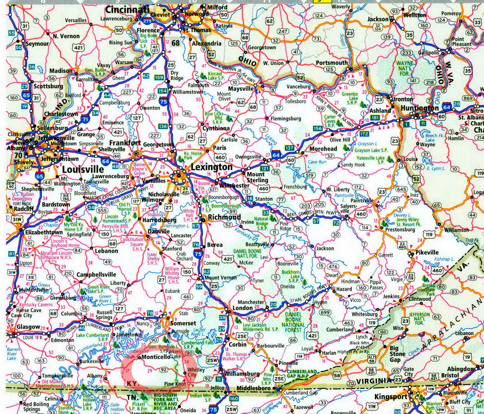
Great Meadow Campground in Kentucky on map

Great Meadow Campground
Great Meadow offers terrific tent camping, hiking, and fishing in the most southwesterly section of the Daniel Boone National Forest.
Being near the end of a dead-end road can have its advantages. Take Great Meadow Campground, deep in the valley of Rock Creek, a Kentucky Wild River with the scenery to match its designation—its clear water cuts between Laurel Ridge and Backbone Ridge. At Great Meadow, tenters can camp along its banks, then fish and hike in both the Daniel Boone National Forest and the adjacent Big South Fork National River Recreation Area, exploring arches and overlooks.
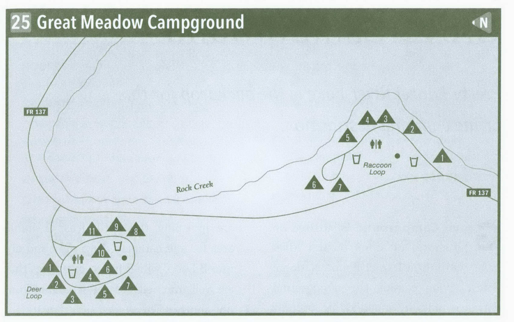
Great Meadow is divided into two separate loops. First come to Deer Loop as you head up the Rock Creek Valley on the
dead-end road. This loop offers above-par privacy. A grassy field dotted with white pines centers the loop. Here, there are vault toilets, a water spigot, and a horseshoe pit. Three of the ю campsites are inside this loop and are more open. The campsites on the outside of the loop back up to a high ridge and are heavily wooded in white pine, oak, sycamore, and hickory. A couple of these sites are doubles.
Just a hundred or so yards farther, on the left-hand side of the road, is Raccoon Loop. This year-round loop, with seven campsites, is directly on Rock Creek. The center of the loop is mostly open and grassy, adding an airy atmosphere to the heavily wooded valley. There is not as much vegetation between campsites, making for less privacy compared with Deer Loop. However, the sites are widely separated.
Immediately on the right is a tiered campsite overlooking the water, beside a large rock beneath a white pine tree. The next site is riverside. A rock wall from settler days is visible across the creek. Water lovers will favor the third site, as it lies adjacent to a pool backed up by rocks in the stream. The fourth site is also on the water. Come to an auto turnaround and a wooded site off the water, far from the others. A final site lies adjacent to the field away from Rock Creek. A horseshoe pit, two newer-style vault toilets, and a water spigot serve the loop. Great Meadow fills on summer weekends and holidays, so get there as early as you can.
Just across Rock Creek is Kentucky's master trail, the Sheltowee Trace, your pathway to the natural attractions in the Rock Creek Valley. Simply ford the creek and catch it going up the valley or down, depending on your whim. Upstream is the Parker Mountain Trail, also accessible by car at the very end of the deadend road, the Rock Creek trailhead. This trail leads west up to Buffalo Arch, on the Tennessee-Kentucky line. It is 2.5 miles one way. Also at the Rock Creek trailhead is a 7.5-mile loop hike over footbridges and past waterfalls, rockhouses, and an old pioneer cemetery. Take the Sheltowee Trace up along Rock Creek to the Coffee Trail; then head back north on the Rock Creek Loop Trail, down along Massey Branch, and back to the trailhead.
Another great hike starts at the Hemlock Grove parking area, 2 miles downstream from the campground. From here cross Rock Creek, and then take the Sheltowee Trace up Mark Branch Trail. The path crosses Mark Branch several times and also squeezes between boulders before reaching Laurel Ridge Road. Turn right on Laurel Ridge Road, and follow it to Forest Road 6102. Turn right on FS 6102, which turns into the Gobblers Arch Trail. Head back down the Gobblers
Arch Trail. Your trip past Gobblers Arch and down to Rock Creek is super steep, but the loop is only 4 miles long.
Anglers will prefer sticking along Rock Creek, stocked with trout and small-mouth bass once a month from March until winter sets in. As summer moves along, the fish will be in the deeper holes. Park biologists suspect the trout are reproducing in this cool stream. I suspect you will have an enjoyable experience at Great Meadow.
Key information about Great Meadow Campground
ADDRESS: P.O. Box 429, Whitley City, KY 42653
OPERATED BY: U.S. Forest Service
CONTACT: 606-376-5323, www . fs . usda . gov / dbnf
OPEN: Raccoon Loop, year-round; Deer Loop, mid-April-mid-November
SITES: 18
SITE AMENITIES: Picnic table, fire ring, lantern post, tent pad
ASSIGNMENT: First come, first served; no reservations
REGISTRATION: No registration
FACILITIES: Water April-November only, vault toilets year-round
PARKING: At campsites only
FEE: None
ELEVATION: 1,000 feet
RESTRICTIONS in Great Meadow Campground
¦ Pets: On 6-foot leash only
¦ Fires: In fire rings only
¦ Alcohol: At campsites only
¦ Vehicles: None
¦ Other: No trash cans-pack it in, pack it out
Getting to Great Meadow Campground
From Exit 11 on I-75 near Williamsburg, head west on KY 92 20 miles to US 27. Stay with Kentucky 92 6.5 more miles, crossing the Big South Fork on the Yamacraw Bridge. Just ahead, turn left on KY 1363, following it 11.5 miles to the end of the blacktop. Turn right here on Forest Service Road 564, following FS 564 1.2 miles to FS 137. Turn left on FS 137, and follow it 4.5 miles to Great Meadow. The Deer Loop is first, on the right; the Raccoon Loop is a bit farther, on the left.
GPS COORDINATES N36° 37.952 W84° 43.657'
