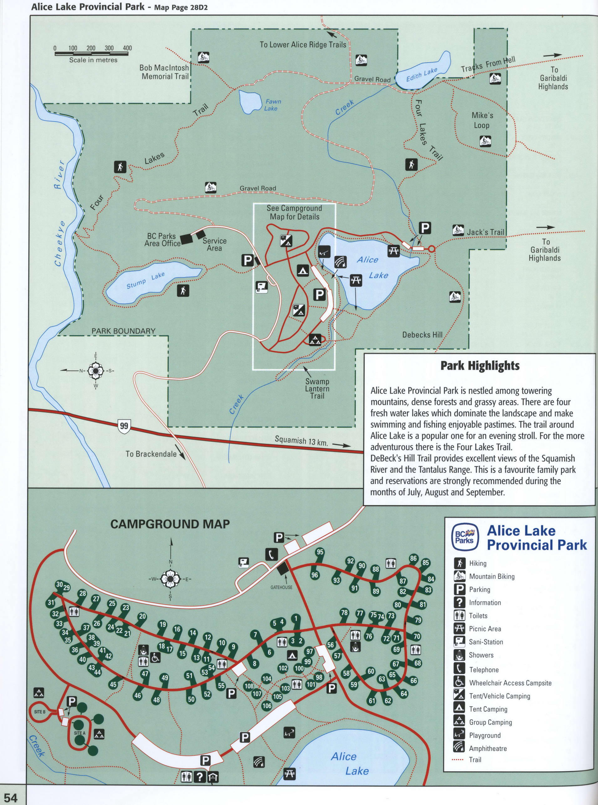
Map of Alice Lake Park in BC
Map of Alice Lake Provincial Park in British Columbia
Map of Alice Lake Provincial Park. Free large image map of Alice Lake Provincial Park, British Columbia, Canada

Highlights of Alice Lake Provincial Park
Alice Lake Provincial Park is nestled among towering mountains, dense forests and grassy areas. There are four fresh water lakes which dominate the landscape and make swimming and fishing enjoyable pastimes. The trail around Alice Lake is a popular one for an evening stroll. For the more adventurous there is the Four Lakes Trail. DeBeck's Hill Trail provides excellent views of the Squamish River and the Tantalus Range. This is a favourite family park and reservations are strongly recommended during the months of July, August and September.
Hiking Mountain Biking Parking Information Toilets Picnic Area Sani-Station Showers Telephone
Wheelchair Access Campsite Tent/Vehicle Camping Tent Camping Group Camping Playground Amphitheatre
Distance by car from Vancouver to the Alice Lake Provincial Park
Distance by car from Vancouver to the Alice Lake Provincial Park 75 km
How to drive from Vancouver to the Alice Lake Provincial Park and route map.