Map of Cultus Lake Provincial Park in BC
Map of Cultus Lake Provincial Park in British Columbia
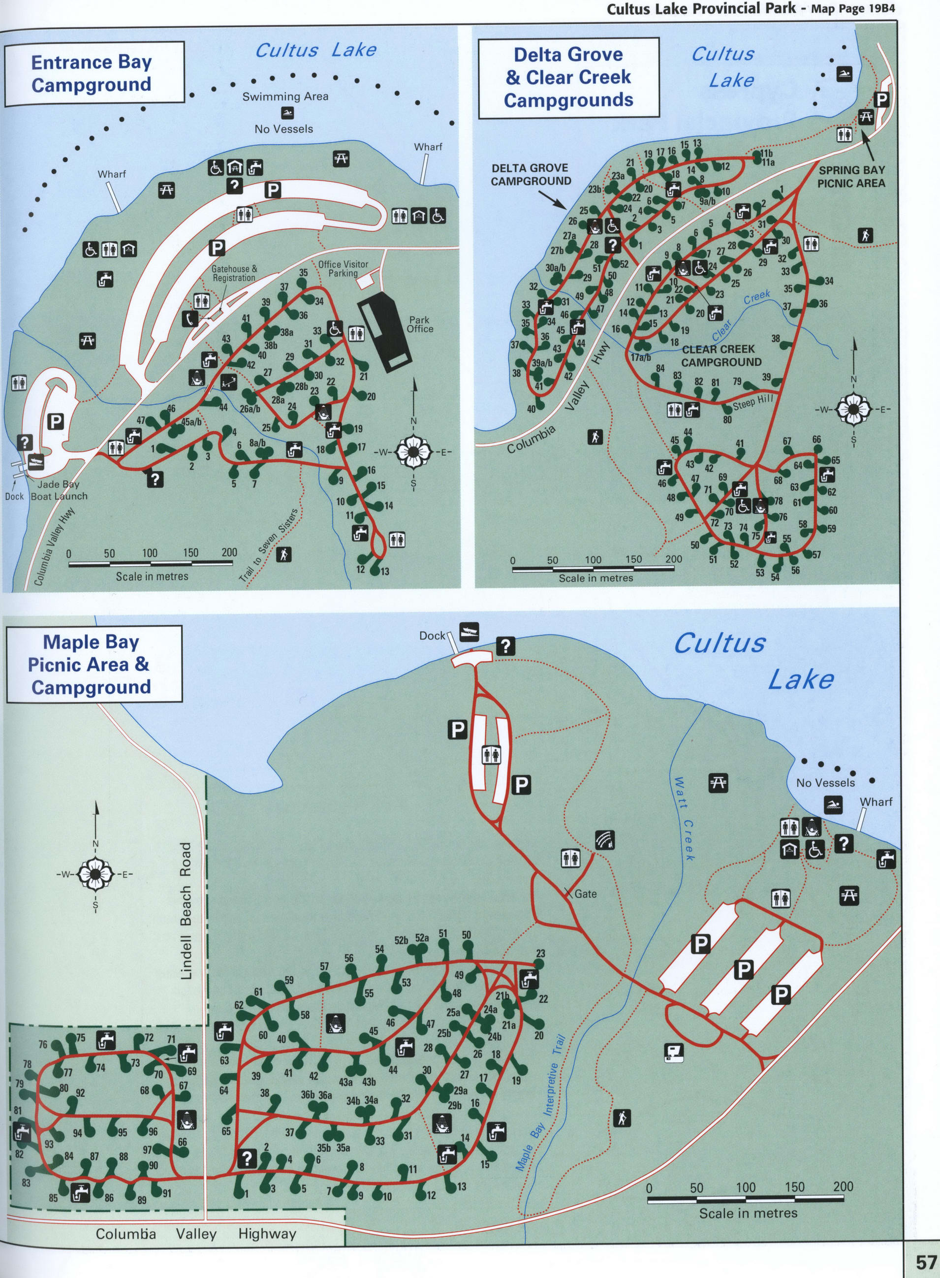
Cultus Lake Provincial Park map. Detailed map of Cultus Lake Provincial Park, British Columbia, Canada.Free printable image map of Cultus Lake Provincial Park.
Detailed Large scale map of Cultus Lake Provincial Park with Mapl Bay Picnic area and campground, Entrance bay campground, Delta Grove and Clear Greek campground.
The distance by car from Vancouver to the Park is about 103 km. Here you can see the route by car from Vancouver.

Highlights of Cultus Lake Provincial Park
As one of the most popular destination areas in the Lower Mainland, Cultus Lake Provincial Park is characterized by a large, warm freshwater lake and scenic forest-clad mountains. The park (2561 ha) is almost evenly divided between the northwest and southeast sides of Cultus Lake. The northwest portion is mostly undeveloped with the visitor-oriented facilities confined to the southeast portion. Visitors will find four campgrounds, a large day-use area for picnicking and boating, and ample opportunity for fishing, water skiing, wind surfing and hiking. Hiking Mountain Biking Parking Information Toilets Picnic Area Sani-Station Showers Firewood
Water Viewpoint Telephone Wheelchair Access Campsite Vehicle/Tent Camping Tent Camping
Group Camping Playground Amphitheatre Boat Launch Swimming Horse Riding
Distance by car from Vancouver to the Cultus Lake Provincial Park 103 km
How to drive from Vancouver to the Cultus Lake Provincial Park and route map.