Map of Cape Scott Provincial Park in BC
Map of Cape Scott Provincial Park in British Columbia
Detailed map of Cape Scott Provincial Park, British Columbia, Canada.Free printable image map of Cape Scott Provincial Park.
Detailed Large scale map of Cape Scott Provincial Park with San Josef Bay, San Josef Heritage park Private campground, Western Forest products campground.
The distance by car from Holberg to the Park is about 16 km.
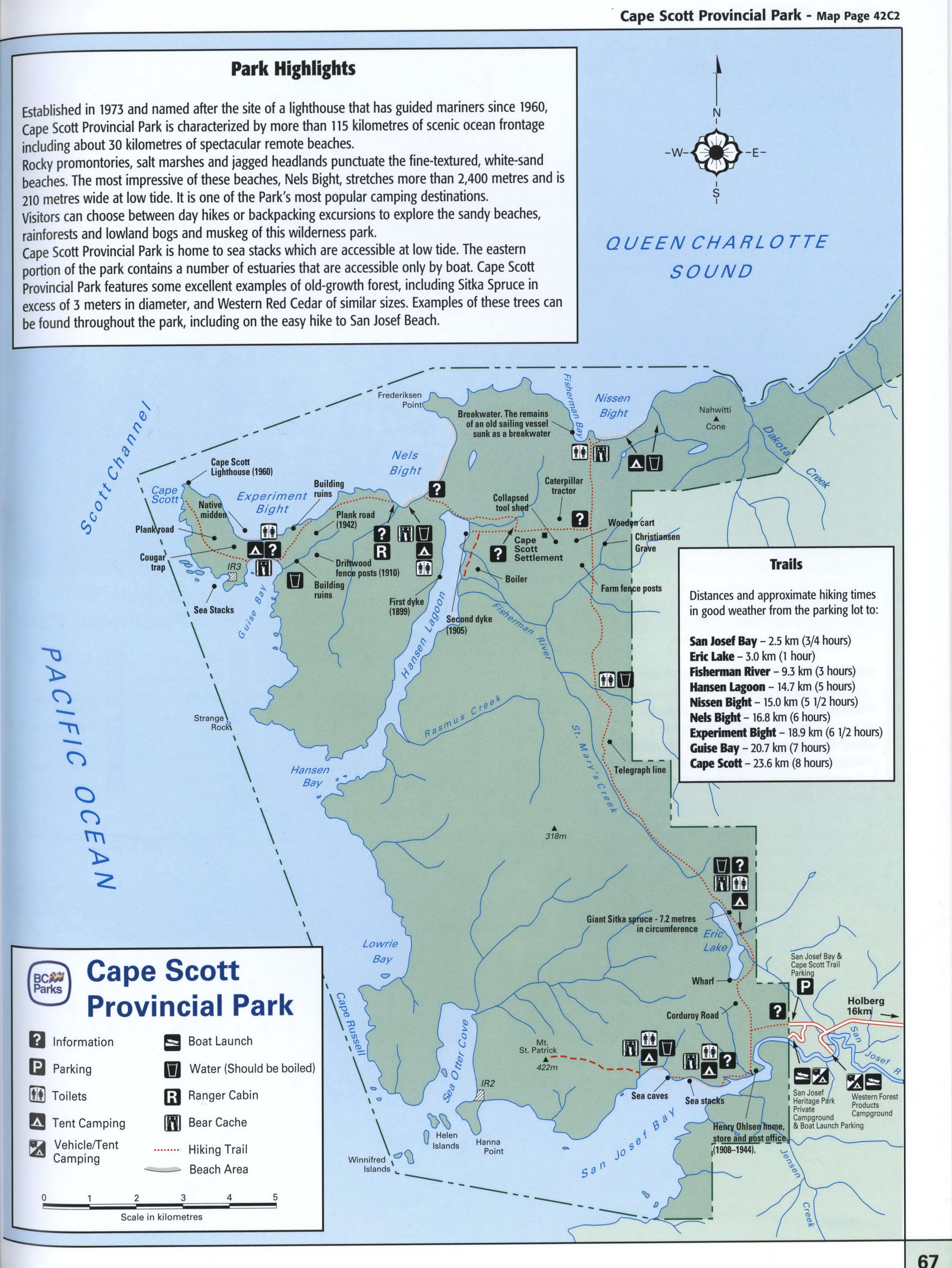
Highlights of Cape Scott Provincial Park
Established in 1973 and named after the site of a lighthouse that has guided mariners since 1960, Cape Scott Provincial Park is characterized by more than 115 kilometres of scenic ocean frontage including about 30 kilometres of spectacular remote beaches.
Rocky promontories, salt marshes and jagged headlands punctuate the fine-textured, white-sand beaches. The most impressive of these beaches, Nels Bight, stretches more than 2,400 metres and is 210 metres wide at low tide. It is one of the Park's most popular camping destinations. Visitors can choose between day hikes or backpacking excursions to explore the sandy beaches, rainforests and lowland bogs and muskeg of this wilderness park. Cape Scott Provincial Park is home to sea stacks which are accessible at low tide. The eastern portion of the park contains a number of estuaries that are accessible only by boat. Cape Scott Provincial Park features some excellent examples of old-growth forest, including Sitka Spruce in excess of 3 meters in diameter, and Western Red Cedar of similar sizes. Examples of these trees can be found throughout the park, including on the easy hike to San Josef Beach.