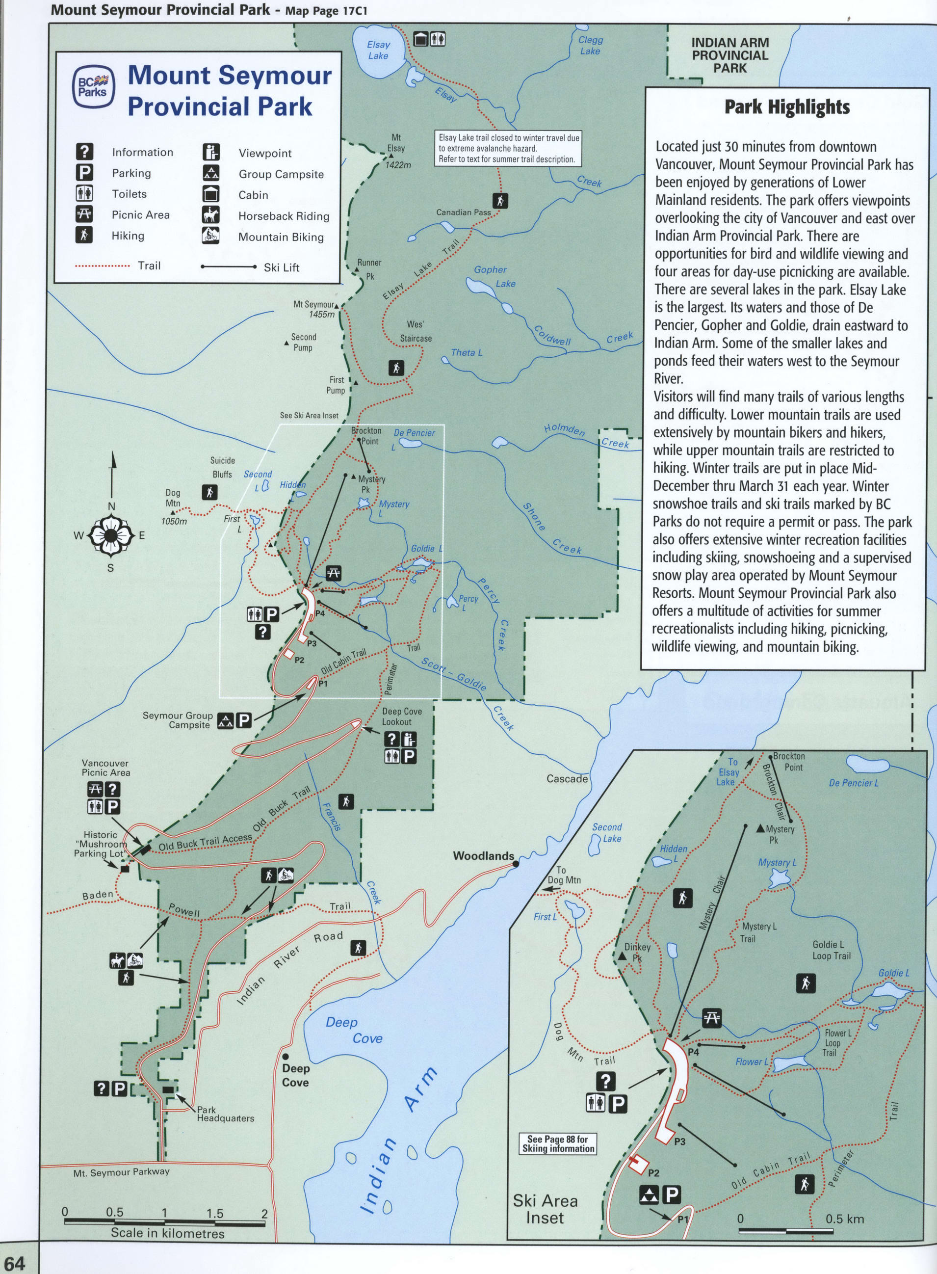
Map of Mount Seymour Park in BC
Map of Mount Seymour Provincial Park
Mount Seymour Provincial Park map. Detailed map of Mount Seymour Provincial Park, British Columbia, Canada

Mount Seymour Provincial Park Highlights
Located just 30 minutes from downtown Vancouver, Mount Seymour Provincial Park has been enjoyed by generations of Lower Mainland residents. The park offers viewpoints overlooking the city of Vancouver and east over Indian Arm Provincial Park. There are opportunities for bird and wildlife viewing and four areas for day-use picnicking are available. There are several lakes in the park. Elsay Lake is the largest. Its waters and those of De Pencier, Gopher and Goldie, drain eastward to Indian Arm. Some of the smaller lakes and ponds feed their waters west to the Seymour River. Visitors will find many trails of various lengths and difficulty. Lower mountain trails are used extensively by mountain bikers and hikers, while upper mountain trails are restricted to hiking. Winter trails are put in place Mid-December thru March 31 each year. Winter snowshoe trails and ski trails marked by BC Parks do not require a permit or pass. The park also offers extensive winter recreation facilities including skiing, snowshoeing and a supervised snow play area operated by Mount Seymour Resorts. Mount Seymour Provincial Park also offers a multitude of activities for summer recreationalists including hiking, picnicking, wildlife viewing, and mountain biking.
Information
Parking
Toilets
Picnic Area
Hiking
Viewpoint
Group Campsite
Cabin
Horseback Riding
Mountain Biking
The distance by car from the city of Vancouver is 25 kilometers. The journey time is 45 minutes.