Map of Regions of California
Map of California regions
California is divided into nine economic regions: Northern California (Del Norte County, Siskiyou, Modoc, Humboldt, Trinity, Mendocino, lake, Lassen, Plumas, Sierra and Nevada), Northern Sacramento valley (Shasta County, the Tihama, Glenn, Butte and Colusa), Greater Sacramento (Sacramento, Yolo, Sutter, Yuba, Placer and El Dorado), Bay Area (SONOMA, NAPA, Solano, Marin, San Francisco, San MATEO, Santa Cruz, contra Costa, Alameda, Santa Clara and San Benito), Central coast (Monterey, San Luis Obispo and Santa Barbara) Valley San Joaquin (County of San Joaquin, Stanislaus, Merced, Madera, Fresno, kings, Tulare and Kern), Central Sierra (County of Amador, Calaveras, Alpine, Thalami, Mariposa, Mono and Inyo), southern California (counties of Los Angeles, Ventura, Orange, San Bernardino and riverside) and the southern boundary (County of San Diego and Imperial).
Map of California regions. Detailed map of economic regions California state.
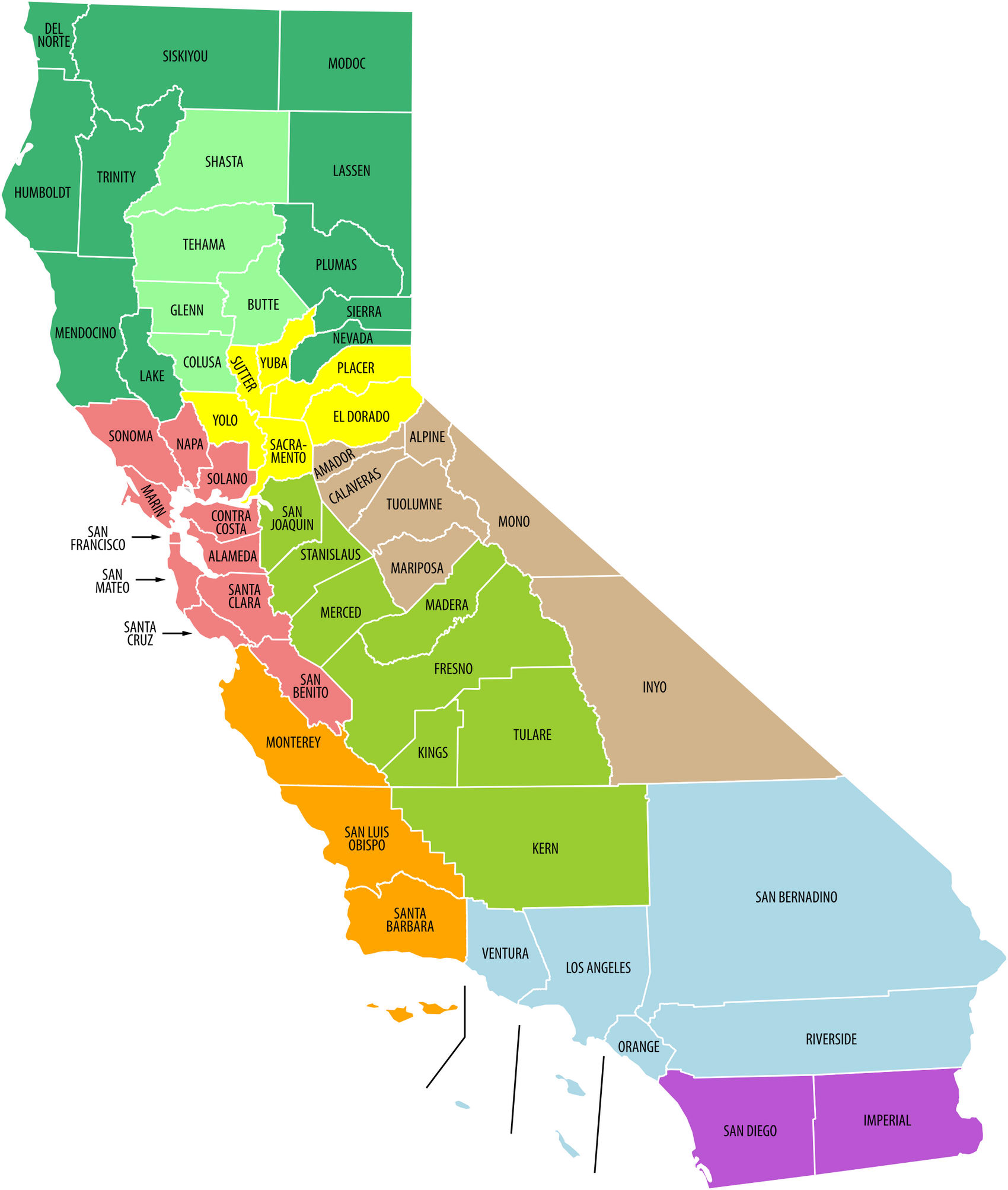
California is divided into nine economic regions:
1.Northern California (Del Norte County, Siskiyou, Modoc, Humboldt, Trinity, Mendocino, lake, Lassen, Plumas, Sierra and Nevada),
2.Northern Sacramento valley (Shasta County, the Tihama, Glenn, Butte and Colusa),
3.Greater Sacramento (Sacramento, Yolo, Sutter, Yuba, Placer and El Dorado),
4.Bay Area (SONOMA, NAPA, Solano, Marin, San Francisco, San MATEO, Santa Cruz, contra Costa, Alameda, Santa Clara and San Benito),
5.Central coast (Monterey, San Luis Obispo and Santa Barbara)
6.Valley San Joaquin (County of San Joaquin, Stanislaus, Merced, Madera, Fresno, kings, Tulare and Kern),
7.Central Sierra (County of Amador, Calaveras, Alpine, Thalami, Mariposa, Mono and Inyo),
8.Southern California (counties of Los Angeles, Ventura, Orange, San Bernardino and riverside)
9.Southern Boundary (County of San Diego and Imperial).