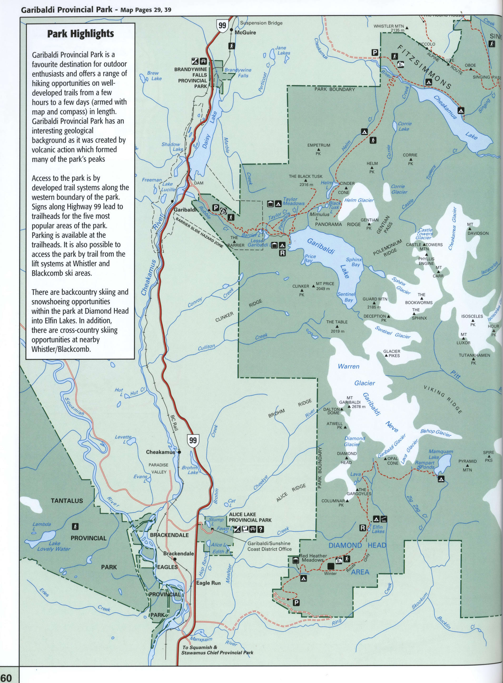
Map of Garibaldi Provincial Park in BC
Map of Garibaldi Provincial Park
Garibaldi Provincial Park map. Free detailed map of Garibaldi Provincial Park, British Columbia, Canada.


Garibaldi Provincial Park Highlights
Garibaldi Provincial Park is a favourite destination for outdoor enthusiasts and offers a range of hiking opportunities on well-developed trails from a few hours to a few days (armed with map and compass) in length. Garibaldi Provincial Park has an interesting geological background as it was created by volcanic action which formed many of the park's peaks.
Access to the park is by developed trail systems along the western boundary of the park. Signs along Highway 99 lead to trailheads for the five most popular areas of the park. Parking is available at the trailheads. It is also possible to access the park by trail from the lift systems at Whistler and Blackcomb ski areas.
There are backcountry skiing and snowshoeing opportunities within the park at Diamond Head into Elfin Lakes. In addition, there are cross-country skiing opportunities at nearby Whistler/Blackcomb.
Vehicle/Tent Campsites
Wilderness Walk-in Campsite
No Camping
Sani - station
Ranger Station
Hiking
Parking
Information
Ski Touring
Mountain Biking
Hut
Day Shelter
Picnicking