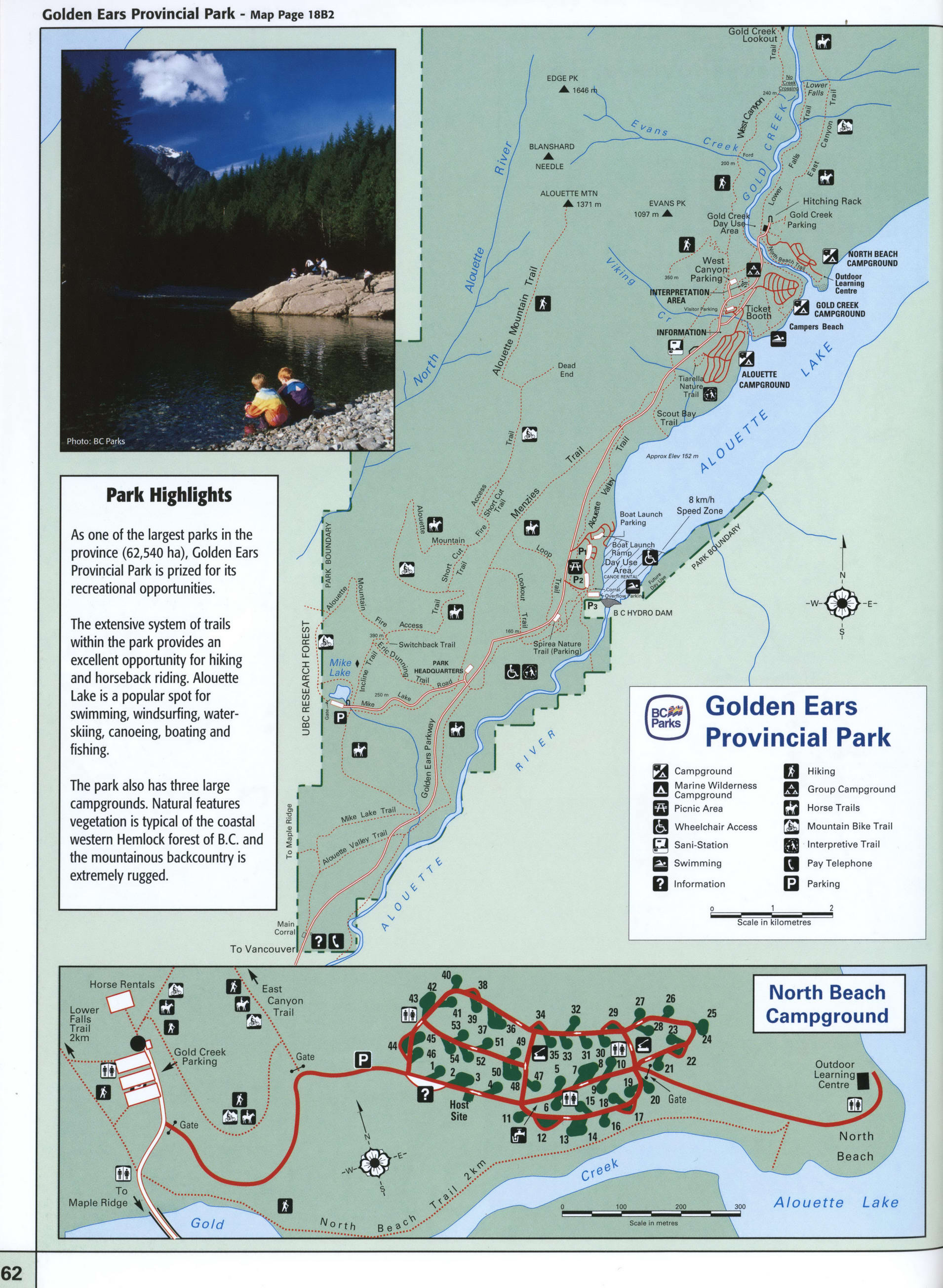
Map of Golden Ears Park in BC
Map of Golden Ears Provincial Park
Golden Ears Provincial Park map. Free detailed map of Golden Ears Provincial Park, British Columbia, Canada.


Golden Ears Provincial Park Highlights
As one of the largest parks in the province (62,540 ha), Golden Ears Provincial Park is prized for its recreational opportunities. The extensive system of trails within the park provides an excellent opportunity for hiking and horseback riding. Alouette Lake is a popular spot for swimming, windsurfing, water-skiing, canoeing, boating and fishing.
The park also has three large campgrounds. Natural features vegetation is typical of the coastal western Hemlock forest of B.C. and the mountainous backcountry is extremely rugged.
Campground
Marine Wilderness Campground
Picnic Area
Wheelchair Access
Sani-Station
Swimming
Information
Hiking
Group Campground
Horse Trails
Mountain Bike Trail
Interpretive Trail
Pay Telephone
Parking
The distance by car from the city of Vancouver is 51 kilometers.